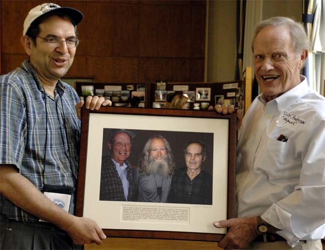
A year ago the founder of the Appalachian Trail Museum Larry Luxenberg attended the IAT’s International AGM and outdoor economy forum in Scotland and Northern Ireland with a contingent from North America.
Continue readingThe IAT is 26 Years Old
April 22nd is the 50th anniversary of the first Earth Day – and the 26th birthday of the IAT!
Continue readingIATNL Commemorates James Cook Survey
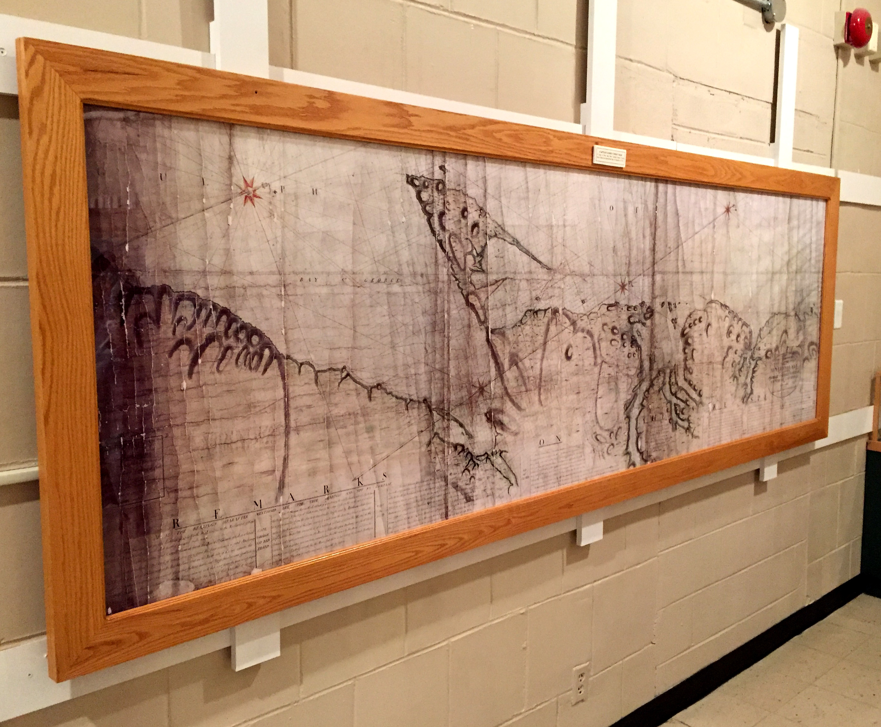
During summer 2017, the International Appalachian Trail Newfoundland & Labrador in conjunction with Cabox Aspiring Geopark is commemorating the 250th Anniversary of British navigator, surveyor, cartographer and explorer James Cook’s survey of Western Newfoundland, his fifth and final year of Newfoundland surveys and tenth and final year in Eastern Canada.
Continue readingHow Spain Discovered the “Apalchens”
As the name suggests, the International Appalachian Trail winds its way across sections of North America’s Appalachian Mountains, before crossing the Atlantic Ocean and following other Pangea related mountains of Western Europe and North Africa. Though the mountains themselves were formed over 250 million years ago when continental plates collided, what is the origin of the name “Appalachian”, the fourth oldest surviving European place name in the United States?

Our story begins with Christopher Columbus (c.1450-1506), an Italian merchant and navigator from Genoa who sought financial support for a westward voyage across the Atlantic Ocean in search of the East Indies.

Columbus was inspired by The Travels of Marco Polo and the ideas of Florentine astronomer Paolo dal Pozzo Toscanelli who theorized that sailing west across the Atlantic Ocean would be a more expedient way to reach the riches of the east.

After twice being rejected by King John II of Portugal (who, after the successful voyage of Bartholomew Diaz around the Cape of Good Hope in 1488, already had a sea route east), Columbus succeeded in receiving support from Spanish Monarchs Isabella I of Castile and Ferdinand II of Aragon.

On August 3, 1492, Columbus set sail from Palos de la Frontera, Spain on his first of four voyages west across the Atlantic Ocean.

After resupplying at Castille’s Canary Islands off the west coast of Africa, he departed September 6 on what would be a 5-week voyage to the Bahama Islands, first sighting land on October 12.

Within 10 years and after 3 more voyages, Columbus had explored most of the Caribbean and the east coast of Central America, where he was told by natives of another ocean to the west.

It was Spanish explorer and conquistador Vasco Núñez de Balboa (c.1475-1519), who in 1513, crossed the Isthmus of Panama and became the first European to reach the Pacific Ocean from the New World.

Fellow conquistador Juan Ponce de León (1474-1521) joined Columbus on his second voyage in 1493, and after serving as the first governor of Puerto Rico (1509-1511), set out on March 4, 1513 to search for new lands rumored to be to the north. On April 2 during the Easter Season (which the Spaniards called Pascua Florida – Festival of Flowers), he sighted a verdant landscape on the east coast of Florida, which he named La Florida.

Fifteen years later, in April, 1528, Conquistador Pánfilo de Narváez and a fleet of 5 ships arrived on the west coast of Florida near what is now Tampa Bay. With 300 men, he landed and marched north through the interior in search of gold and other riches, until they reached a Native American village near present-day Tallahassee, whose name they transcribed as Apalchen or Apalachen.

Encountering hostility from the natives, they retreated to the coast where Narváez was swept out to see on a raft and never seen again. After eight years and many ordeals, only 4 survivors lived to reach Spanish forces in Mexico. In the years that followed, the names Apalchen and Apalachee were used to describe the Florida tribe and interior region to the north.

The Diego Gutiérrez map of the New World (above and below) entitled Americae Sive Quartae Orbis Partis Nova Et Exactissima Descriptio was printed in 1562 and was the first to record the names “Apalchen” (or a derivative) and “California”. It was printed in Antwerp for the Casa de Contratación, the Spanish government agency which attempted to control all Spanish exploration and colonization.

In 1539, explorer and conquistador Hernando de Soto led an expedition of 620 men and 220 horses deep into what is now Florida, Georgia, the Carolinas, Tennessee, Alabama and possibly Arkansas. He was fascinated by the stories of Cabeza de Vaca, one of the four survivors of the 1527-1536 Narváez expedition. With the help of Spaniard Juan Ortiz who was found living with the native Mocoso, de Soto recruited a series of local guides who were able to communicate with neighbouring tribes, thus acquiring local knowledge of the regions he crossed.

The expedition spent its first winter at Anhaica, capital of the Apalachee. The following year it journeyed northeast through Georgia, South Carolina (where de Soto was received by female chief Cofitachequi) and North Carolina (where the men spent a month searching for gold in the Appalachian Mountains), before turning west and south into Tennessee, Georgia and Alabama.

The following year the expedition headed west and reached the Mississippi River, where in May 1542, de Soto died of fever. His men continued on under the command of Luis de Moscoso Alvarado and reached Texas, before turning back and sailing down the Mississippi to the Gulf Coast.

Though the De Soto expedition failed to find riches or establish a colony, it did contribute greatly to European knowledge of the geography, biology and ethnology of the land known as Florida. French artist and cartographer Jacques le Moyne de Morgues used it in his 1565 map of Florida, which was the first to use “Apalachee”, or the Latin “Apalatci”, to refer to the Appalachian Mountains.


Before long the entire southeast north of Florida – which itself spanned all of the southeast – became known as the land of Apalche, or Apalachee. The mountains to the north became known as the Allegheny Mountains, purportedly derived from the Lenape word for ‘fine river’.

In 1569, Flemish cartographer Gerardus Mercator completed a world map entitled Nova et Aucta Orbis Terrae Descriptio ad Usum Navigantium Emendate Accommodata, which was the first to show the Appalachian Mountains as a continuous mountain range stretching along the east coast of North America. It was also the first map to use the Mercator projection, whereby lines of constant compass bearing are straight lines on the map.

By the 19th century, both “Appalachian” and “Allegheny” were applied to the entire length of the eastern mountain system, replacing numerous more localized names such as Endless, Black and Smoky mountains. “Appalachian” became favored for the whole system following the publication of A.H. Guyot’s study On the Appalachian Mountain System in 1861, which is credited with securing scientific usage of “Appalachian”, and eventually leading to the popular endorsement of the term (Stewart, 1945).

In an ironic twist to the Appalachian story, the Conquistador Hernando de Soto was born in 1496 in Extremadura, Spain, near the country’s Appalachian mountain cousins … y El Sendero Internacional de los Apalaches!
Early Portuguese Exploration of North America
In 1498, just one year after Italian explorer Giovanni Caboto rediscovered North America and six years after fellow Italian Christopher Columbus “discovered” the New World, Portuguese explorers João Fernandes Lavrador and Pêro de Barcelos were the first modern explorers of much of northeastern North America, including the Labrador Peninsula. They were followed (1500-02) by Portuguese explorers Gaspar and Miguel Corte Real. This is the story of Portuguese exploration of North America, the fourth in the IAT Natural and Cultural Heritage Series.

In 1295, when Italian merchant Marco Polo returned to his native Venice after 24 years travelling across Asia to China with his father Niccolò and uncle Maffeo, few Europeans had any knowledge of lands beyond the Near East, where four years earlier, 200 years of Christian military campaigns to the Holy Land known as the Crusades had ended.

However the Polos returned at a time when Venice was at war with Genoa, another wealthy Italian city-state with an extensive Mediterranean trading network. After outfitting a galley for war, he was soon captured and imprisoned for approximately 3 years, during which time he dictated a detailed account of his travels to fellow prisoner Rustichello da Pisa, who after adding his and other tales, published a book with the English title The Travels of Marco Polo.

Though written before the invention of Gutenberg’s printing press (c. 1439), the book was widely copied in many languages, inspiring merchants, seamen and nobility with tales of riches in the far east. Already experienced traders in the eastern Mediterranean, Italian city-states were well positioned to capitalize on increased trade with Arab and Turkish middlemen.

However in the early 15th century, another bold and visionary European had another idea. He would pursue trade directly with the far east, avoiding non-Christian middlemen. Portugal’s Infante Dom Henrique de Avis, Duke of Viseu, better known in the 20th century as Henry the Navigator (1394-1460), would devise a plan to reach Asia by sailing around Africa, from the Atlantic to Indian Ocean.

In 1415 at the age of 21, Henry convinced his father, King John I, to conquer the port of Ceuta on the North African coast. This Moorish stronghold in the Strait of Gibraltar had long been used as a base for Barbary pirates who raided the Portuguese coast, capturing locals and selling them in the African slave market. Soon after, he was exploring the West African coast, hunting pirates and seeking the source of the area’s lucrative gold trade and the legendary Christian Kingdom of Prester John.

Because Mediterranean ships of the era were too slow and heavy for these dangerous forays into the Atlantic Ocean, a new and much lighter ship was developed that was faster and more maneuverable. Rigged with 2 or 3 lateen sails, these shallow-keeled Portuguese caravels of 50 to 150 tons were able to tack against the wind and sail upriver into shallow coastal waters.

Soon Henry’s explorers were discovering new lands in the eastern Atlantic, including the Madeira Islands (1420) and Azores (1430), which were quickly colonized. They also discovered the volta do mar (Portuguese for “turn of the sea“), the navigational technique whereby mariners returning to Portugal from the west coast of Africa had to follow the clockwise currents and trade winds and sail northwest to reach northeast. This was a major innovation in Atlantic navigation that would play a major role in future exploration. By the time of Henry’s death in 1460, Portuguese caravels had discovered the Cape Verde Archipelago and circumvented the Muslin land-based trade routes across the western Sahara Desert, thus enabling direct trade for gold and slaves.

During the generation that followed, Portuguese explorers continued south along the west coast of Africa until 1488 when Bartolomeu Dias sailed around the southernmost tip of the continent, becoming the first European to reach the Indian Ocean from the Atlantic. Four years later in 1492, Christopher Columbus followed the volta do mar on his first voyage west across the Atlantic Ocean in search of the East Indies.

On October 12 he landed on a Bahamian Island which he claimed for supporting monarchs Ferdinand II of Aragon and Isabella I of Castile, after being rejected by King John II of Portugal on the basis that his estimated travel distance of 2400 miles was far too low and Diaz had already rounded the “Cape of Good Hope” for an eastern maritime route to Asia.

This new discovery precipitated a dispute between Spain and Portugal, which had been granted all lands south of the Canary Islands in the Alcaçovas Treaty of 1479, which ended the War of the Castilian Succession (1475-1479). The dispute was resolved by the Treaty of Tordesillas in 1494, which divided all new lands in the Atlantic Ocean between the Portuguese and Spanish empires along a meridian 370 leagues west of the Cape Verde Islands, approximately halfway between those islands and the islands discovered by Columbus in 1492. Lands to the west of the meridian would belong to Spain, while lands to the east would belong to Portugal.

In just three years, Venetian Giovanni Caboto became the first European to reach Newfoundland in North America since the Norse Greenlanders, approximately 500 years earlier. Sailing with a royal patent from England to find a northwest route to the East Indies, his discovery would complicate future Portuguese and Spanish claims to the New World.

That same year, Vasco da Gama departed Portugal for India, following Diaz’s route south into the Indian Ocean, where in 1498 he became the first European to reach India by sea. Two years later, countryman Pedro Álvares Cabral followed the counter clockwise ocean currents and trade winds of the South Atlantic on his voyage to India, and in the process discovered the northeast coast of South America, claiming the future “Brazil” for Portugal.

While Cabral was exploring the southwest Atlantic, Portuguese explorer Gaspar Corte-Real and his brother Miguel were exploring the northwest and reached what is believed to be Newfoundland. Though Miguel returned to Portugal with two of the expedition’s three ships, Gaspar continued southwards and was never heard from again. Miguel met the same fate the following year, when he set off in search of his younger brother. As a result of these voyages the names Terra Cortereal and Terra del Rey de Portuguall began to appear on European maps of the day.

The Corte Reals were following in the wake of fellow Azores countryman João Fernandes Lavrador, who in 1498 was granted a patent by Portuguese King Manuel I to search for new lands on the Portuguese side of the Tordesillas Meridian. He reached Greenland and Labrador, named Island of Labrador and Land of Labrador, respectively, and was granted title to many of the lands he discovered. In 1501, he too was lost at sea in the North Atlantic.

The Portuguese Pedro Reinel Map of 1504, the world’s first to include lines of latitude, clearly shows the Canadian regions of Labrador, Newfoundland and Cape Breton, as well as the Strait of Belle Isle and Cabot Strait.

500 years earlier, the coast of Labrador and Strait of Belle Isle were familiar to Norse explorers from Greenland, beginning with Leif Erikson who established the settlement of Vinland at the tip of Newfoundland’s Great Northern Peninsula.

In 1534 and 1535, Jacques Cartier entered the Gulf of St. Lawrence via the Strait of Belle Isle during his first two voyages of discovery. In 1536 after overwintering in “Canada”, he returned to France via the Cabot Strait, thus becoming the first European on record to determine Newfoundland to be one or more islands.

Though the first French explorer of “Canada”, Cartier was not the first explorer flying the French flag in North America. in 1524, Florentine Giovanni da Verrazzano explored the east coast from North Carolina to Newfoundland in the service of King Francis I.

For the next half century, the Strait of Belle Isle continued to establish itself as Canada’s Heritage Gateway, when whaling fleets from the Basque region of France and Spain (whose King Phillip II was also crowned Philip I of Portugal in 1581) hunted right and bowhead whales as they migrated through the strait between the Gulf of St. Lawrence and Labrador Sea.

In spite of the Portuguese claim to North America under the Treaty of Tordesillas and the voyages of João Fernandes Lavrador and Gaspar Corte-Real, Giovanni Caboto’s discovery of Newfoundland on behalf of King Henry VII of England one year before Lavrador’s voyage in 1498 established “British title to the territory composing [Canada and] the United States. That title was founded on the right of discovery, a right which was held among the European nations a just and sufficient foundation, on which to rest their respective claims to the American continent. Whatever controversies existed among them (and they were numerous), respecting the extent of their own acquisitions abroad, they appealed to this as the ultimate fact, by which their various and conflicting claims were to be adjusted.” (Commentaries on the Constitution of the United States, by Joseph Story, LL. D, U.S. Supreme Court Justice, and Dane Professor of Law, Harvard University, 1833).

The English claim to North America was disputed by its historic rival France, based on the voyages of Jacques Cartier who discovered the St. Lawrence River and the interior of “Canada”. After the English victory in the Seven Years War (French and Indian War in North America, 1754-1763), England finally gained possession of the continent and quickly employed James Cook to survey and chart the Strait of Belle Isle and French Shore of Newfoundland, which together with the islands of St. Pierre and Miquelon, were the only remaining territories under limited French control.

The victory was short lived. Twenty years later, England lost the southern half to the American States during the Revolutionary War for independence.
As for Portugal, they continue to fish in Newfoundland waters, an enduring tradition lasting over 500 years. In Labrador, one of the biggest employers today is the mining company Vale, a Portuguese language multinational based in the Tordesillas Meridiancountry of Brazil.

And in Portugal, the country proudly remembers their classic age of exploration, a time when their country was without equal on the high seas.


