The Board of the Maine IAT and I personally give a heartfelt Congratulations! to Eb “Nimblewill Nomad” Eberhart who, at age 83, became the oldest person to hike the Appalachian Trail.
Continue reading
The Board of the Maine IAT and I personally give a heartfelt Congratulations! to Eb “Nimblewill Nomad” Eberhart who, at age 83, became the oldest person to hike the Appalachian Trail.
Continue reading
As happens every spring, a dedicated group of Maine IAT volunteers spent a few days on the trail in the Katahdin Woods & Waters National Monument clearing winter blowdowns (aka wind-falls or windthrows), checking lean-tos and re-stocking toilet paper in the privies.
Continue reading
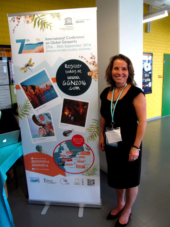
On September 27-30, IATNL / Cabox Aspiring Geopark Chairperson Paul Wylezol attended the 7th International Conference on UNESCO Global Geoparks at Torquay, England, where he learned more about the UNESCO Global Geopark programme and gave a presentation on next year’s 250th Anniversary of James Cook completing his surveys of Western Newfoundland and Eastern Canada.
Continue reading
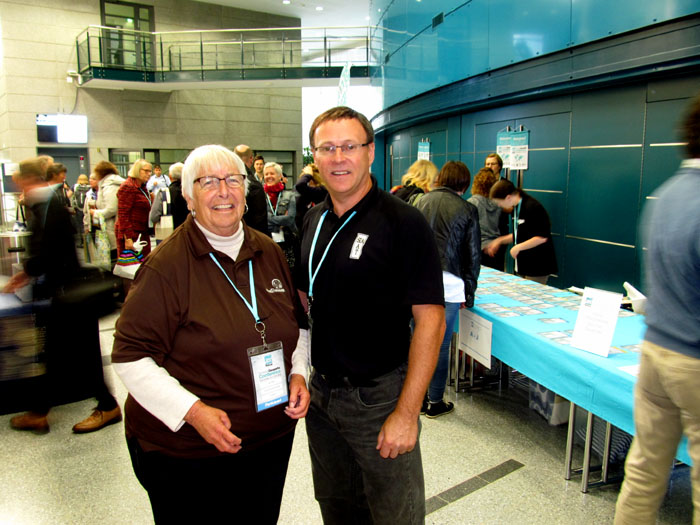
On September 19 to 25, IAT Ulster Ireland hosted the International Appalachian Trail Annual General Meeting, from Slieve League in County Donegal to Ballycastle, County Antrim. The week-long event included scenic hikes, historic tours, fine dining and tasty beers, all with the great hospitality this beautiful emerald island is renowned for.
Continue reading
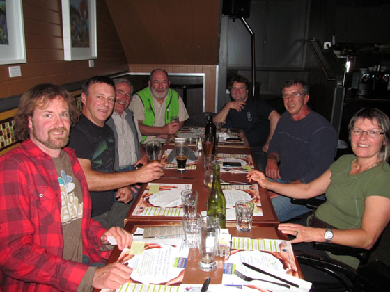
The 24th gathering for the annual meeting of the Maine Chapter of the International Appalachian Trail began at the Patten Lumberman’s Museum at 3:00 pm on Thursday, May 3rd.
Continue reading
At the 24th annual IAT Maine meeting, President Don Hudson surprised long-time Board Member and IAT Chief Geologist Walter Anderson with a formal certificate recognizing him as an Honorary Director.
Continue reading
On August 24th in 2016, an 87,563-acre plot of land in the heart of Maine was designated the Katahdin Woods and Waters National Monument by former President Barack Obama. Although met with controversy on all sides, the area had yet been explored on a large scale. In September 2017, a team of four Maine-born photographers set out on a three-part journey through Katahdin Woods and Waters to investigate.
Continue reading
The Appalachian Trail Conservancy held the workshop and business component of its 2017 Biennial Conference at Colby College in Waterville, Maine, between Friday, August 4th and Sunday, August 5th. The International Appalachian Trail was well-represented by a North American contingent, including Maine Chapter Board Members Dick Anderson, Don Hudson, Earl Raymond, and Herb Hartman, as well as Poul Jorgensen from New Brunswick and Paul Wylezol from Newfoundland.
Continue reading
During summer 2017, the International Appalachian Trail Newfoundland & Labrador in conjunction with Cabox Aspiring Geopark is commemorating the 250th Anniversary of British navigator, surveyor, cartographer and explorer James Cook’s survey of Western Newfoundland, his fifth and final year of Newfoundland surveys and tenth and final year in Eastern Canada.
Continue reading
On April 10, 2017, IAT Maine honored former Maine Governor Joe Brennan for helping launch the International Appalachian Trail on Earth Day 1993.
Continue reading
At their meeting in December, the Baxter State Park Authority closed access to Katahdin Lake along the route from the east while the park evaluates the potential impacts of the new Katahdin Woods and Waters National Monument.
Continue reading
From October 12 to 15, a small group of Greenland youth from the Uummannaq Peninsula and their Danish leader René Kristensen were in Western Newfoundland to hike sections of the IATNL. They were joined by French film maker Marc Buriot and arrived from St. John`s where they attended an Inuit Studies Conference and screened local Greenland films, including INUK.
Continue reading
At the IAT Annual General Meeting in Strabane, Northern Ireland on September 22, IAT Ulster Ireland officials expressed interest in touring sections of IAT Scotland to learn about trail planning and development by their northern neighbour.
Continue reading
On November 17, representatives from the International Appalachian Trail, Appalachian Trail Conservancy, Appalachian Mountain Club and the mayors of Donegal, Ireland and Derry City and Strabane District Council, Northern Ireland met at the AMC headquarters in Boston, Massachusetts.
Continue reading
Highlighted by a blaze of fall colors, Board Members of the Maine Chapter of the International Appalachian Trail (MaineIAT) traveled along the Mohawk Trail (Rt.2) to Williams College, Williamstown, Mass. to attend the 3-day 35th Annual Gathering of the Appalachian Long Distance Hikers Association (ALDHA).
Continue reading![]()
On September 16 & 17, IAT Chairperson Paul Wylezol was in England visiting the Captain Cook Memorial Museum in Whitby and Captain Cook Birthplace Museum in Marton. While there he gave a presentation on the 250th Anniversary of James Cook completing his surveys in Eastern Canada, most noteably in Newfoundland. In the coming years, James Cook 250 will a unique opportunity for the IAT and partner UK National Trails to promote their natural and cultural heritage across the North Atlantic and South Pacific. The visit began … where else? … checking into the Endeavour pub with accommodations in Whitby.
![]()
The pub is located just around the corner from the Captain Cook Memorial Museum, which is housed in the 17th century Walker House on Grape Lane. The harbourside house owned by Captain John Walker was where the young James Cook lodged as an apprentice and trained as a seaman. It has a large courtyard overlooking the harbour, where Whitby colliers were once built and set sail for trade in the North and Baltics Seas. It stands 3-stories, with the ground floor furnished according to an inventory of 1754 and the other two floors containing exhibits of Cook related maps, paintings and other artifacts.
![]()
Paul was given a tour of the museum by Sophie Forgan, Chairperson of Trustees
before giving a presentation in the new reception area adjacent to the entrance. In addition to maps showing Cook’s survey work in Nova Scotia, Quebec and Newfoundland & Labrador it also included excerpts from Memorial University of Newfoundland (Grenfell Campus) History Professor Olaf Janzen’s recent paper entitled The Significance of James Cook’s Newfoundland Years.
![]()
From Whitby, Paul travelled to the nearby Captain Cook Birthplace Museum in Marton. The modern museum is located in Stewart Park near the city of Middlesbrough and was built near the location of Cook’s birthplace cottage. It opened October 28, 1978 on the 250th Anniversary of the explorer’s birthday. It houses a variety of exhibits, from Cook’s childhood and formative years in England to his navy and surveying years in Eastern Canada and three voyages of discovery to the Pacific Ocean. Cook’s five years surveying the vast and remote coastline of Newfoundland is recognized as ideal preparation for his role of leading the 1768 voyage to the Pacific to witness the transit of Venus.
![]()
As in Whitby, Paul’s presentation focused on Cook’s time in Nova Scotia, Quebec and Newfoundland & Labrador and the 2017 James Cook 250 Anniversary celebration planned by the IATNL and Western Newfoundland’s Cabox Aspiring Geopark, to coincide with the 150th Anniversary of the Confederation of Canada. After the presentation and Q&A, Paul went on a walking tour of the grounds with Senior Museum Curator Phil Philo and IAT partner Cleveland Way National Trail Manager Malcolm Hodgson, who helped arrange the visit and presentations. Many thanks to Phil and the staff at the Captain Cook Birthplace Museum, as well as Sophie, Peter and the staff at the Captain Cook Memorial Museum in Whitby, for the warm welcome and opportunity to present the 250th Anniversary story of Cook in Eastern Canada.
Many thanks also to Malcolm and Memorial University of Newfoundland (Grenfell Campus) History Professor Olaf Janzen for contributing his recent Cook in Newfoundland paper. We hope to see you all again in 2017! For more on the story, go to love Middlesbrough blog.
On August 24, U.S. President Barack Obama used his executive authority to create the Katahdin Woods & Waters National Monument on land donated to the federal government by entrepreneur and conservationist Roxanne Quimby. More than 87,500 acres of forestland in Maine’s fabled North Woods was designated in honor of the 100th Anniversary of the National Park Service, in a historic but unilateral decision following years of bitter debate.
![]()
The new national monument – which will be managed by the National Park Service – will include “the stunning East Branch of the Penobscot River and a portion of the Maine Woods that is rich in biodiversity and known for its outstanding opportunities to hike, canoe, hunt, fish, snowmobile, snowshoe and cross-country ski. In addition to protecting spectacular geology, significant biodiversity and recreational opportunities, the new monument will help support climate resiliency in the region. The protected area – together with the neighboring Baxter State Park to the west – will ensure that this large landscape remains intact, bolstering the forest’s resilience against the impacts of climate change.”
“Following years of support from many local and state elected officials, tribal leaders, businesses and members of the public across the state, this designation will build on the robust tradition of growing the park system through private philanthropy, and will reinforce the need to continue protecting our great outdoors as we enter the second century of the National Park Service. The land has been donated to the Federal Government by philanthropist Roxanne Quimby’s foundation, Elliotsville Plantation, Inc., facilitated by the National Park Foundation as part of its Centennial Campaign for America’s National Parks. In addition to the donation of the land, the approximately $100 million gift includes $20 million to supplement federal funds for initial park operational needs and infrastructure development at the new monument, and a pledge of another $20 million in future philanthropic support.”
With the stroke of a pen, Obama created the second national monument in Maine history after Acadia National Park’s precursor – on land east of Baxter State Park in an area facing severe economic uncertainty. The move is likely to delight conservation activists and infuriate local opponents fearful the designation is trading potential industrial-based opportunities in the Katahdin region for mostly seasonal tourism jobs. While organizations such as the Katahdin Area Chamber of Commerce hope it will lure more tourists and create jobs, opponents warned it could further destabilize a forest products industry struggling to rebound from the closure of the Millinocket and East Millinocket paper mills. Many others have mixed views, seeing significant jobs potential but not in the industry that was once the backbone of the region. Nevertheless, the designation is a substantial yet partial victory for Roxanne Quimby, the wealthy co-founder of the Burt’s Bees product line whose nonprofit, Elliotsville Plantation Inc., donated the land to the federal government this month. Quimby has pushed for years for a full-fledged national park in the North Woods but sought a lesser monument designation because it did not require congressional approval. On August 28, she was joined by Lucas St. Clair and his twin sister Hannah Quimby to host a grand celebration on the shores of Millinocket Lake at New England Outdoor Center’s Twin Pine Camps. The Natural Resources Council of Maine, The Wilderness Society, The Pew Charitable Trust, the National Parks Conservation Association, and the Conservation Lands Fund joined Roxanne, Lucas, and Hannah in thanking everyone who contributed to securing the designation of the Katahdin Woods & Waters National Monument by President Barack Obama. IAT Maine’s Don Hudson, Phine Ewing, Walter Anderson, Elaine and Eric Hendrickson, Lindsay and Michael Downing, Mark and Susan Adams, Bart DeWolf, former board member Eric Horschak, Aaron Meguier, Terry and Craig Hill, and numerous other IAT members and friends were on hand to bask in the great excitement and appreciation sparked by the Quimby family’s generous gift — the largest gift to the people of the United States since the days of John D. Rockefeller and Paul Mellon. The New England Outdoor Center’s Matt Polstein welcomed nearly 300 people to the formal gathering, looking out across Millinocket Lake to Katahdin, shortly after 5:00 pm. Sunday, August 28th. The highlight speeches were made by Secretary of the Interior, Sally Jewell and Liliane Willens. Secretary Jewell spoke about the significance of the gift to the nation, the importance of land such as this to the health and well-being of all Americans, and the special qualities of the land — the East Branch of the Penobscot, the hiking opportunities — especially the IAT, and the richness of the geologic heritage.
Liliane Willens, Roxanne’s aunt, regaled the crowd with stories about her family’s path from Russia, through Shanghai, to the United States beginning after the Russian Revolution and concluding at the end of World War II. Lily believes Roxanne developed qualities of perseverance, grit, and determination from her maternal grandmother, who had lead the family through much of that trek. When Lucas St. Clair addressed the crowd he too raised a great laugh of appreciation when he spoke about the power and dominance of women in his family, and how at a young age he learned not to second guess either his mother’s wisdom or her determination to get a job done. Lucas was clearly relieved that this particular job was done!
The hard-working staff of NEOC provided the wonderful setting for the gathering, along with delicious food and drink. Dave Mallett and his band took the party deep into the night with an endless serenade for the party-goers. The first 31 miles of the IAT is now on land considered by President Barack Obama to be a national treasure, and we agree!
When Bryson Guptill saw there was interest in the International Appalachian Trail on Prince Edward Island, he decided to try it out for himself. It took him and another six days to finish. “It was very cool”, he said.
Here’s Bryson’s story, as told by Charlottetown’s The Guardian newspaper. The International Appalachian Trail is part of network along the mountain range in the Atlantic provinces, Quebec, Maine, Greenland and several European countries. In P.E.I., the trail stretches 150 kilometres, including long stretches along the Confederation Trail. It’s an offshoot of the Appalachian Trail, which starts in Georgia, runs more than 3,500 kilometres to Mt. Katahdin in Maine and takes anyone dedicated enough to try it several months to finish.
Guptill said he made a map of what he thought was the International Appalachian Trail route in P.E.I., posted it to the Island Trails Facebook page and watched as interest spiked. Usually the page gets about 100 views in a week, but the map got more than 4,000 in the first day, Guptill said. “I thought holy crap there’s a whole lot more interest in the (International) Appalachian Trail than I had thought about.” Although he had the route mapped, Guptill said he wanted to make sure it was actually passable from start to finish. He said someone he knew had International Appalachian Trail signs someone sent her, but nobody ever placed them. So he took them and decided to walk the entire route.
Guptill walked the trail with an alternating group of people, including Sue Norton who kept him company throughout the entire trek starting in Borden-Carleton on July 6. They stayed in bed and breakfasts along the way, he said. “We thought that would be more fun than coming home.” Guptill said he had biked the trail before, but wanted to try it at a slower pace. “The thing is when you walk it you see so much more,” he said.During the International Appalachian Trail trip the weather cooperated and the temperatures stayed very cool, he said. Guptill also said he learned a lesson in the importance of putting some mileage on his feet before trying such a long hike. “Your feet just will take a pounding,” he said.
On June 20 after some delay, Tom Stevenson, project manager for Scotland’s Mull of Galloway Trail and member of the Rotary Club of Stranraer, became the first IAT representative to receive a British Empire Medal. The presentation was made by Lord Lieutenant of Wigtown Dr John Ross at a Rotary meeting at North West Castle Hotel, Stranraer, and was attended by many of the members who helped create the Mull of Galloway Trail.
In May, Tom and his wife Sheila attended a Royal Garden Party at Buckingham Palace, which was also attended by the Queen, Duke of Edinburgh and many other members of the Royal Family. All recipients of the BEM are invited to a Royal Garden Party and while residents of Scotland normally go to Edinburgh, Tom and his wife – who previously attended an event at Holyrood Palace – were able to arrange travel to London. They remained for four days and visited the Houses of Parliament (where they saw processions going to and from the State Opening of Parliament) and Royal Mews directly opposite their hotel on Buckingham Palace Road.
Tom first found out about the nomination in November 2015, but kept it secret from family and friends – except his wife – until December 30. “I was surprised and delighted when I found out,” he said. “I hope it will be good for both the trail and the club.”
The Mull of Galloway Trail continues to be well used and the number of website visitors keeps increasing every year. During 2015 the site had over 15,000 unique visitors and over 1,000,000 hits. This spring and summer Tom and his crew were busy doing maintenance and improvements on the trail, with the local Council agreeing to cover many of the costs.
In May 2015, the Rotary Clubs of Stranraer, Ayr, Gourock, and Allander gathered at Milngavie to inaugurate the Firth o Clyde Rotary Trail, a partnership of the Mull of Galloway Trail, Ayrshire Coastal Path and Clyde Coastal Path.
At Milngavie, the 161 mile (266km) IAT Scotland route through the Lowlands meets the West Highland Way, and continues north to Fort William and the Cape Wrath Trail.
Congratulations Tom Stevenson BEM!
… and the Mull of Galloway Trail and Stranraer Rotary!
From September 19 to 25, IAT Ulster-Ireland will host the 2016 IAT Annual General Meeting in Strabane, Northern Ireland. The weeklong event begins at the Ulster American Folk Park in Omagh, where the IAT chapter was officially launched in August 2013.
It then moves west to Slieve League and the county of Donegal in the Republic of Ireland, where American Appalachian hiker Cotton Joe Norman began the first IAT Ulster-Ireland thru-hike in September 2013.
The trail starts at the 601 meter (1972 ft) Slieve League on the Atlantic coast then crosses the Blue Stack Mountains before entering Northern Ireland. It then picks up the Ulster Way and passes the Giant’s Causeway on the stunning northern coastline, before traversing the Glens of Antrim.
After Donegal, the AGM schedule moves to Derry/Londonderry for a pre-AGM tour, followed by the Annual General Meeting in Strabane. The tentative schedule of weeklong activities is:
A list of accommodation is being prepared, and it is hoped that delegates will stay in Castlederg / Derg Valley area of County Tyrone, close to the trail and border with County Donegal. Transport will be provided every day from and to Castlederg, including all trips up to and including the AGM in Strabane. On Friday morning, delegates will be transported to the North East Coast for the weekend’s itinerary.
For more complete visitor information, including transportation links and accommodations list, download the Delegate Information Guide, then go to the IAT Ulster-Ireland website and start planning your visit!
On April 8 & 9, IAT North America held its Annual Spring Council Meeting in Mabou, Nova Scotia, a Gaelic speaking region of Cape Breton.
The two-day event held at Duncreigan Inn was an opportunity for the U.S. and Canadian chapters to gather to discuss common issues and joint initiatives, as well as provide updates on regional and international progress.
Day One began with a welcome from IAT Nova Scotia hosts Claire MacNeil and John Calder followed by chapter updates, beginning with Maine. Don Hudson discussed a new IAT route through a proposed national forest reserve, the Pioneers of Appalachian/Caledonian Geology website series, as well as opportunities surrounding next year’s ATC Biennial in Maine.
IAT New Brunswick’s Poul Jorgensen discussed his chapter’s new southern route that will connect with IAT Nova Scotia. The route includes sections of the Trans Canada Trail and crosses Stonehammer UNESCO Global Geopark.
Leo Gill of IAT Prince Edward Island discussed the success his chapter has had developing trails across the island, connecting to IAT New Brunswick across the Confederation Bridge in the north and IAT Nova Scotia via the Woods Island ferry in the south.
Claire MacNeil and John Calder described potential IAT routes in Nova Scotia, from the Cape to Cape and Trans Canada Trails linking to New Brunswick and the proposed Sea Wall Trail at the northeastern end of Cape Breton Island.
Paul Wylezol of IAT Newfoundland & Labrador completed the chapter updates with a presentation on the IATNL’s plan to develop a UNESCO Global Geopark across the Bay of Islands Ophiolite Complex and commemorate (in 2017) the 250th Anniversary of James Cook’s survey and map of Western Newfoundland, spanning the entire route of the IAT from Port aux Basques in the south to Cape Raven (near the Norse UNESCO World Heritage Site at L’Anse aux Meadows) in the north. He also gave an update on the EU funded Drifting Apart project.
After the chapter updates, representatives posed for the traditional group mugshot before heading to the Mull Cafe and Deli for a well-earned meal and refreshments.
The evening session began with a presentation by David Williams on the planned Seawall Trail at the northeastern end of Cape Breton Island, which may become an extension of IAT Nova Scotia. It was followed by a presentation on the Trans Canada Trail in Eastern Canada by trail guide author Michael Haynes.
The last presentation of the day was given by environmentalist Norris Whiston, who gave a presentation on the ecological environment and various plant species found along the IAT Nova Scotia trail route.
Day Two of the meeting was a ‘Nuts and Bolts’ session reserved for common issues and projects, including website and social media, maps and guides, and sponsorship guidelines. Nova Scotia’s John Calder (who is a committee member with the Canadian Geoparks Network) closed out the meeting with a presentation on UNESCO Global Geoparks, including the planned Fundy Rim Geopark in Nova Scotia.
A special thanks goes out to Claire MacNeil, John Calder and the staff at Duncreigan Inn for for a pleasant and productive IAT North America Council Meeting in Cape Breton.
Thanks also to guest presenters David Williams, Michael Haynes and Norris Whiston for their interesting presentations. Good luck to you all on your various projects.
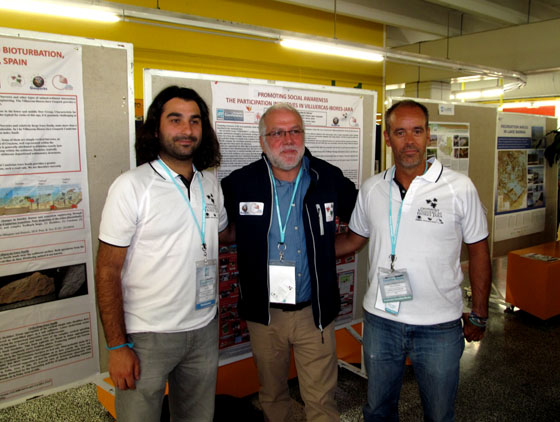
The 3rd general meeting of Newfoundland’s Cabox Aspiring Geopark was held Friday, March 4 at Memorial University’s Grenfell Campus in Corner Brook, with approximately 40 people in attendance. In addition to updates on the past year’s developments and a review of the upcoming application process, MUN Geologist Andy Kerr gave a special presentation entitled ‘Newfoundland, the Bay of Islands, and the Geological Revolution’.
IAT / Cabox Aspiring Geopark Chairperson Paul Wylezol outlined the GeoSite categories, beginning with five geological groupings: Ancient Continental Slope, Transported Continental Margin, Bay of Islands Ophiolite Complex, Little Port Island Arc Complex, and Carboniferous Cover Rocks of the Deer Lake Basin.
On February 22-23, IAT/Cabox Aspiring Geopark Chairperson Paul Wylezol attended the Geological Association of Canada Regional Technical Meeting at the Johnson Geo Centre in St. John’s, where he gave a presentation on the International Appalachian Trail, UNESCO Global Geoparks and Cabox Aspiring Geopark in Western Newfoundland.
The Spring 2016 Issue of Earth Heritage Magazine features their first story on the International Appalachian Trail. Check out the 45th issue of this “geological and landscape conservation magazine” for a detailed update on how far we’ve come and where we’re headed!
![]()
For this and other interesting geological and landscape conservation stories, download the Spring 2016 Issue of Earth Heritage Magazine.
The International Appalachian Trail Newfoundland & Labrador (IATNL) has begun planning trail improvements for 2016, including on the Humber Valley Trail, Grand Codroy Way, and French Shore Trail near Conche, with volunteers Katie Broadhurst and Alex Fortin channeling girl power! They have recently begun developing a plan to increase the local volunteer base, in particular among young adults who appreciate outdoor adventure and physical fitness.
They are seeking adventure-loving low-maintenance volunteers to help on popular yet under-maintained scenic trails. There is lots to do, but they know how to get ‘er done and still have fun!
For 2016, volunteer “work” will include trail maintenance, new trail development, back country cabin renovations, and lots and lots of HIKING! The goal is to have one trail enhancement project per month, whether one day local or multi day back country.
Plans call for a kick off in May with a gathering of volunteers to review the summer plan, cover basic trail maintenance techniques, and meet all of the fellow volunteers! They will then put it all into action with a little maintenance on the Old Man in the Mountain section of the Humber Valley Trail.
For more on the story, go to the IATNL website.
A committee of IAT geologists including Walter Anderson, Robert Marvinney, Jim Hibbard, John Calder, and Hugh Barron have established guidelines and selected the first group of deceased honorees who are being recognized for their significant contribution to the understanding of Appalachian/Caledonian geology. Look for the stories of these Pioneers of Appalachian/Caledonian Geology on the IAT website soon!
![]()
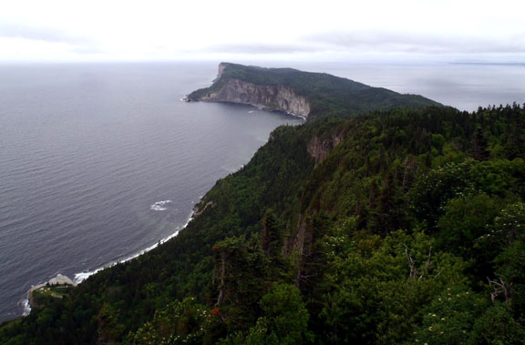
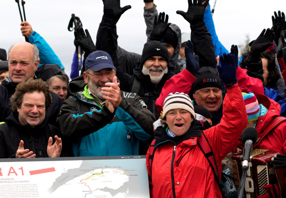
On October 2, the International Appalachian Trail Québec and France’s Fédération Française de la Randonnée Pédestre (FFRP) officially designated IAT Québec (IAT-QC) as North America’s first Grande Randonnée (“Great Hike”) – the GRA1 (America 1) – at Forillon National Park.
![]()
The international event took place at Cap Gaspé and marked the closing of the second Traversée de la Gaspésie (TDLG) on Foot (TDLG) on Foot, which ran from September 26 to October 3.
The GR designation is part of an international strategy aimed at strengthening ties between IAT Québec and the Fédération Française de la Randonnée Pédestre (French Hiking Federation) and promoting hiking in Western Europe and North America.
The FFRP first traveled to Gaspésie with information on the GR program in October 2013. In 2014, IAT Québec was granted GR designation, with permission to use the famous white and red trail markers.
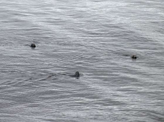
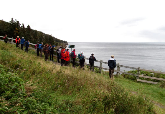
The October 2 Launch was preceded by an IAT/FFRP dinner and refreshments at Brise Bise pub in the town of Gaspé and a morning trek along the coast of Forillon National Park where hikers were treated to about a dozen gray seals who swam in for the celebrations!
These began with music and song along the trail and in the lighthouse shed where approximately 100 hikers gathered for the main event!
![]()
Next up was opening introductions and official statements by Parks Canada, IAT, TDLG and RRPF officials followed by the unveiling of a new GRA1 sign to more music and much applause.
The bilingual sign describes IAT Québec and the GR® designation and outlines the route on a map of the Gaspé Peninsula.
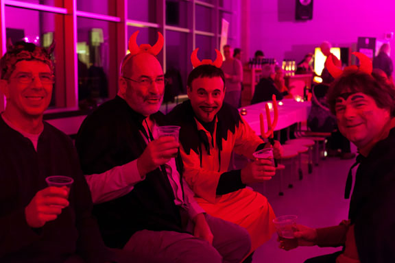
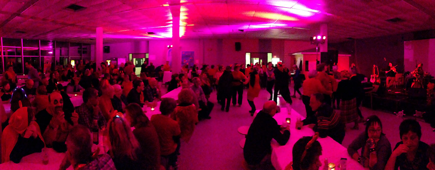
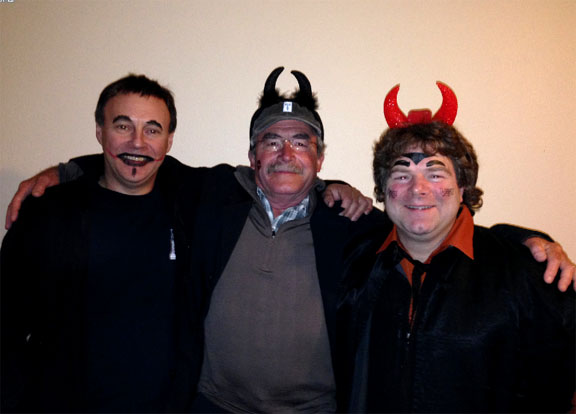
The festivities continued throughout the day, and ended at night with a satanic themed costume party in the town of Gaspé. For more information on IAT Québec and the new GRA1, go to the SIA-IAT website. If you see any devils along the route, touch a trail marker and tell 10 friends they must walk the IAT!!!
On September 3-5, IAT Chairperson Paul Wylezol attended the European Geoparks Conference in Oulu, Finland, where he gave a presentation on the International Appalachian Trail and its connection to Global Geoparks. The IAT crosses 12 Global Geoparks and Aspiring Geoparks in Canada, Western Europe and Morocco.
![]()
The 3-day event was held at the University of Oulu and the nearby Rokua Geopark, and was attended by over 400 representatives from European, Canadian and other Global Geoparks and Aspiring Geoparks.
Day One began with opening welcome by local officials – including Conference Chair Vesa Krökki – and keynote speeches by Global Geoparks President Professor Nickolas Zouros and UNESCO Representative Dr Margarete Patzak followed by a variety of themed presentations by geopark, tourism and conservation organizations.
Many focused on the development and maintenance of Global Geoparks while the IAT presentation – entitled International Appalachian Trail partners with European Geoparks – introduced the IAT and its potential connection between Geoparks found along the IAT route, and was given in association with Carlos Neto de Carvalho and IAT partner Naturtejo Geopark of Portugal. Day Two was reserved for field trips to Rokua Geopark or a walking tour of the city of Oulu.
Day Three began with a keynote presentation by Dr Rauno Väisänen, Director of Metsähallitus Parks & Wildlife Finland followed by more presentations on themes such as conservation, education and communication.
During coffee and lunch breaks between sessions, participants used the opportunity to view poster presentations and interact with guest presenters and geopark representatives. Day Three ended with a closing dinner at Rokua Health & Spa Hotel where Global Geoparks President Nickolas Zouros announced the results of the 2015 Geopark re-evaluations and welcomed 5 new European Geoparks, bringing the total to 69. He also repeated a Day One prediction that the Global Geoparks Network will receive full UNESCO designation (on par with World Heritage Sites) during the 38th UNESCO General Conference in November, thereby becoming UNESCO Global Geoparks.
For more on the 2015 European Geoparks Conference, go to the conference website or the European Geoparks website.
On the beautiful morning of August 17, IAT/IATNL Chairperson Paul Wylezol and IATNL Finance Director Kevin Noseworthy set off in a dory from Cox’s Cove, Bay of Islands with Darren Park of Four Seasons Tours in search of Middle Arm geosites for the IATNL planned Cabox Global Geopark.
The Geopark will feature 3 basic zones of the Humber Arm Allochthon: the Ancient Continental Shelf of North America, the Transported Continental Margin of North America, and the Bay of Islands Complex Ophiolite Massifs.
The tour’s first stop was Middle Arm Point between Humber Arm and Middle Arm. Its exposed and weather-beaten headland is a good example of the Zone 2 Cook’s Brook Formation.
![]()
There you can see layers of sedimentary limestone and sandstone folded in unique patterns when tectonic collisions closed the Iapetus Ocean and formed the Appalachian Mountains more than 250 million years ago.
![]()
![]()
From Middle Arm Point, the trio turned back and headed east into Goose Arm and the rising sun. For more on the story, go to the IATNL website.
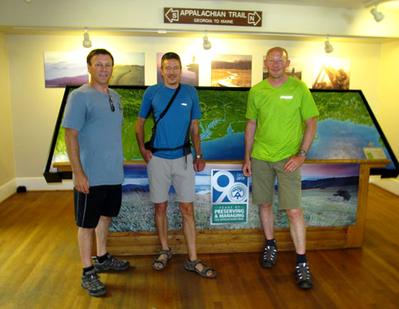
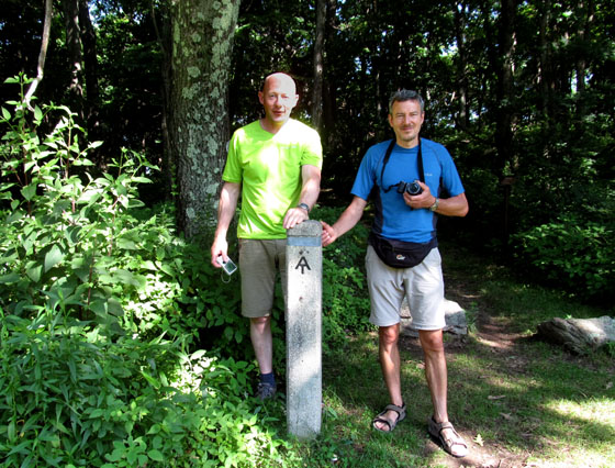
On July 17-19, the IAT attended the ATC 2015 Biennial at Shenandoah University in Winchester, Virginia where it gave 3 hours of presentations and distributed information from an extra large conference booth.
![]()
Among the 1000+ in attendance were IAT Founder Richard “Dick” Anderson (Maine), IAT Geologist Walter Anderson (Maine), IAT Maine President Don Hudson, IAT Chairperson Paul Wylezol (Newfoundland), IAT Europe Vice President Hugh Barron (BGS, Scotland), UK National Trails Rep Mark Owen (England) and distinguished Appalachian geologist Jim Hibbard from North Carolina State University.
After registration on Friday, July 17, the conference began with a series of workshop presentations on Saturday morning. IAT Founder Richard “Dick” Anderson opened for the International Appalachian Trail with a review of the early years of the trail’s formation.
Dick was followed by Jim Hibbard who worked with renowned Appalachian geologist Harold “Hank” Williams on his Tectonic Lithofacies Map of the Appalachian Orogen, which he continued to update and digitize until his recent retirement. Jim gave a presentation on Appalachian geology from Georgia to Newfoundland, where Williams created his innovative and colorful maps.
Paul then introduced the concept of Global Geoparks as it relates to the IAT and the EU Northern Periphery and Arctic Programme’s Drifting Apart project aimed at “unearthing and strengthening the understanding, appreciation and enjoyment of the fascinating and interconnected geological heritage of the Northern Periphery and Arctic region, and its many links to natural, built and cultural heritage.” It will “support the development of new and aspiring Global Geoparks, promote innovative products and services for social and economic prosperity, and continue to build a strong network of Geoparks in the Northern Periphery and Arctic Region.”
IAT Europe Vice President Hugh Barron of the British Geological Survey – who has helped develop Geoparks in Scotland – gave a more detailed presentation on the European Geoparks program, describing criteria for inclusion and maintenance, and identifying many of the Geoparks along the IAT route in Europe.
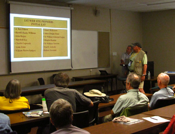
IAT Maine President Don Hudson kicked off the second round of IAT presentations by introducing the IAT’s upcoming Pioneers of Appalachian/Caledonian Geology series. IAT Geologist Walter Anderson followed with a detailed description of the website series and the names of the 15 honourees included in the first round selection. Stay tuned for a special feature on the Pioneers!
Mark Owen of England’s South West Coast Path – hosts of the 2014 IAT AGM – gave a presentation on UK National Trails and a slideshow on his own SWCP. He also introduced Plymouth 400, the celebration planned around the 2020 anniversary of the Mayflower Pilgrims’ voyage to the New World.
The final IAT presentation was by Hugh Barron, who gave an update on IAT Scotland, including the newly launched Firth o Clyde Rotary Trail from the Mull of Galloway in the southwest to Milngavie at the southern end of the West Highland Way near Glasgow. He also discussed a possible new link between IAT Scotland and IAT England.
After the presentations, the IAT delegation presented Appalachian Trail Museum President Larry Luxenberg with a copy of the Appalachian Orogen map developed by “Hank” Williams and Jim Hibbard, before shifting to the conference exhibition hall, where the IAT booth showcased its many flags, posters and maps and distributed IAT promotional material.
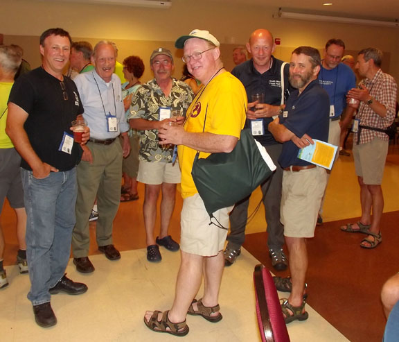
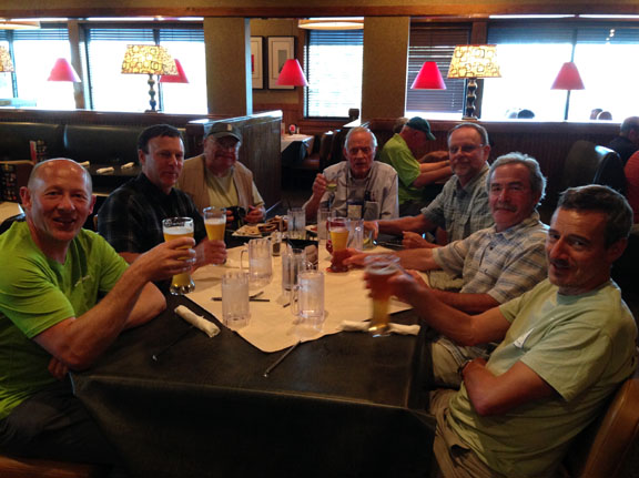
On Saturday night, the group gathered at a local restaurant for the traditional IAT meal, before retiring back to the hotel for a round or two of well-deserved liquid refreshments.
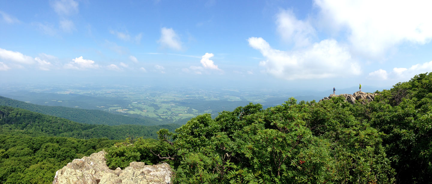
On Sunday morning, Mark, Hugh and Paul hiked sections of the Appalachian Trail in Shenandoah National Park then visited the ATC Visitor Center in Harper’s Ferry, West Virginia before joining a meeting with ATC Executive Director Ron Tipton and Director of Conservation Laura Belleville.
Ron and Laura were presented with the second copy of the Appalachian Orogen map developed by “Hank” Williams and Jim Hibbard. IAT participation in the week-long 2015 Biennial came to an end Sunday evening, July 19, but not before two productive days of promoting the International Appalachian Trail and networking with ATC hikers and officials.
![]()
Many thanks go out to the Appalachian Trail Conservancy and their members for making the IAT feel at home. We hope to return the favour some day and look forward to participating in the ATC 2017 Biennial near the end of the AT – and beginning of the IAT – at Mount Katahdin, Maine!