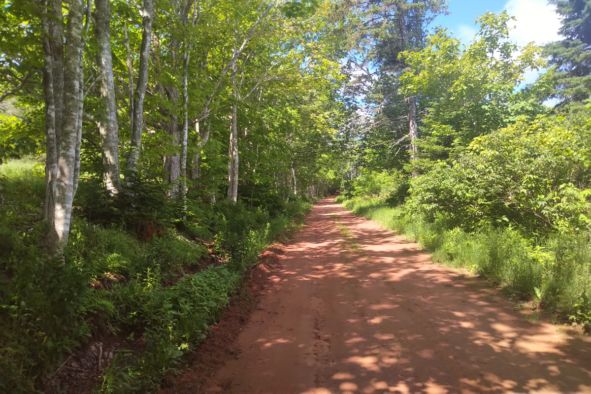
Despite the ongoing ebb and flow of the Coronavirus, many IAT/SIA chapters are reporting fair to large numbers of hikers on their particular section of trail.
Continue readingSpring Trail Work on the IAT in Maine
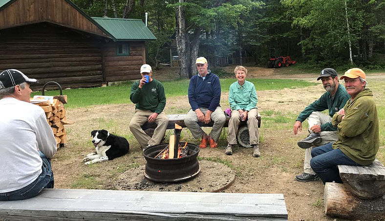
As happens every spring, a dedicated group of Maine IAT volunteers spent a few days on the trail in the Katahdin Woods & Waters National Monument clearing winter blowdowns (aka wind-falls or windthrows), checking lean-tos and re-stocking toilet paper in the privies.
Continue readingBaxter State Park closes Katahdin Lake Trail access from KWW National Monument
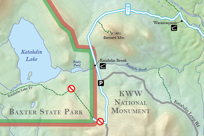
At their meeting in December, the Baxter State Park Authority closed access to Katahdin Lake along the route from the east while the park evaluates the potential impacts of the new Katahdin Woods and Waters National Monument.
Continue readingMaine to Reroute 52 Miles of IAT
The International Appalachian Trail continues to draw hikers to northern Maine, offering a tour through varied landscapes and a connection to Canada and beyond.
This summer, the Maine chapter is aiming to reroute 52 miles of the trail that currently is set along roadways in southern Aroostook County. About 65 miles of trail are currently set along a road shoulder.
The roughly 13 miles along Grand Lake Road from Matagamon to Shin Pond is actually “good road walking,” with wide shoulders and few trucks, and that will remain a part of the route, Hudson said. For the other 52 miles, the chapter is working with landowners to reroute the trail from Shin Pond to Monticello, aiming to move the trail to old woods roads and all-terrain vehicle trails. A section they’ve secured will run along the south side of Mount Chase, and offer a link to a trail up the 2,440-foot mountain of the same name.

“The idea is in the long-run to get rid of the bulk of the road walking, and to use a combination of woods roads and paths,” including multi-use ATV trails, said Hudson, the former president of the Chewonki Foundation in Wiscasset.
For more on the story, go to the Bangor Daily News – Maine Outdoors website.
IAT Crosses the Mediterranean into Africa
In July 2015, the International Appalachian Trail crossed the Mediterranean Sea from Spain into Morocco. The addition of the African country marks the third and final continent of IAT expansion beyond borders to all “Appalachian” regions once connected on the super-continent Pangea more than 250 million years ago, when the Appalachians, Caledonians, and Anti Atlas Mountains were formed.

The first phase of IAT Morocco will extend approximately 600 kms from Midelt to Taroudant and be divided into 3 sections – Midelt to Megdaz, Megdaz to Imlil (High Atlas Central), and Imlil to Tagmout (near Taroudant) – taking a combined 40+ days to complete on foot.

Along the way, hikers will experience geography, culture and religious traditions unlike anything previously experienced along the IAT, from deserts to Berbers to the Muslim call to prayer.

Highlights include Jebel Ayachi (the highest peak in the middle Atlas), 700m high Tatrout gorge, the famous Plateau Lakes and fortified cliffside village of Irherm n’ Ouchtim, the ridge of Mgoun (the second highest peak in North Africa) and Megdez, arguably the most beautiful village in the Atlas Mountains.

Next up are Anghomer Pass (Tizi n’Timlilt, 3100m) and the tremendous views of Ouazarzate and Jebel Sahro range, Ardrar Mahboub with its superb views south towards the Sahara, Yagour Plateau (well-known for rock carvings), and Mount Toubkal, at 4167m, the highest peak in the High Atlas and North Africa.

Others include the Sultan’s Kasbah Gandafa Palace (17th century), Tinmal Mosque (12th century), Jebel Imaradene summit, and the plateau of a thousand peaks.

The IAT Morocco blaze (i.e., trail marker) contains the familiar IAT/SIA layout, with the addition of the country’s flag on top and IAT QR code at bottom.
 Blazes are currently being installed along the route, with the assistance of IAT partner Morocco Trek and local volunteers. Hikers looking for assistance in finding the route and planning their IAT Morocco adventure can contact Morocco Trek at http://www.moroccotrek.co.uk/.

Rotary Clubs Launch Scotland’s FoCRT
On a sunny Saturday, May 9, 2015, Sally Magnusson, broadcaster, top news presenter for BBC Scotland, writer and journalist, officially opened the 161-mile (266km) Firth o Clyde Rotary Trail in Milngavie – next to the start of the West Highland Way – in front of members of the public, the Rotary Clubs of Stranraer, Ayr, Gourock, Allander, and their guests – including IAT Europe vice-president Hugh Barron representing IAT Scotland.

Rotary could not have chosen a better person for the job, as Sally’s late father was the celebrated Icelander Magnus Magnusson, presenter of the BBC “Mastermind” Quiz Show, one-time President of Scottish Natural Heritage, and also the “Paths For All” Charity who encourage local footpath development and healthy exercise.

Plaque at Milngavie Introduced by her host, Iain White (Allander and the new Clyde Coastal Path), Sally unveiled two commemorative plaques – one of which had been carried in relay by teams of Rotarians to Milngavie all the way from the Mull of Galloway (to where it will return). A keen walker herself, she duly declared – ‘Scotland is rich in beautiful places to walk, but for me there is nothing better than a coastal path, and I look forward to walking this one’.

Tom Stevenson (Stranraer and the Mull of Galloway Trail) then presented her with a cheque for £1000 for her charity in memory of her late mother Maimie, also a famous journalist – ‘Playlist for Life’ (providing favourite music for dementia sufferers’ on iPod).

In thanking Sally, Jimmy Begg (Ayr and the Ayrshire Coastal Path) said this occasion was the realisation of an eleven-year aspiration; and paid tribute to the huge amount of work undertaken – firstly by members of Ayr Rotary Club in creating the Ayrshire Coastal Path in 2008, and then to the members of Stranraer Rotary Club who rose to the challenge to connect up the Mull of Galloway in 2012 – and to Gourock and Allander Rotary Clubs, who did likewise with the final link, the Clyde Coastal Path in 2015.

He also thanked Scottish Natural Heritage and Visit Scotland for the accolade of Scotland’s Great Trail awarded to both the ACP and the MGT, and made special mention of the excitement and pleasure they’d felt away back in Oct 2010, when the International Appalachian Trail invited the ACP (and subsequently the MGT and CCP trails) to become part of IAT Scotland, forming a vital link with Ireland and the West Highland Way.

Now complete, the Firth o Clyde Rotary Trail (FoCRT) will prove a major asset to the Scottish walking tourism industry, linking as it does with a number of existing long-distance routes in Scotland. The tough/gentle nature of the trail should encourage everyone – from families on a day out to serious walkers – to take to the outdoors, and enjoy the stunning scenery and superb natural environment.
FoCRT comprises three autonomous long distance trails, the Ayrshire Coastal Path (2008), the Mull of Galloway Trail (2012) and the Clyde Coastal Path (2015), created by the Rotary Clubs of Ayr, Stranraer, and Allander and Gourock, respectively.

The Mull of Galloway Trail (36 miles/60km) starts at the Mull Lighthouse, perched on steep cliffs at the southernmost point in Scotland, with fine prospects of the Isle of Man and Ireland’s Mountains of Mourne, before travelling up the sheltered eastern shore of the Rhinns, with big sky views over Luce Bay to the Machars and the distant Galloway Hills. Passing through rich farmland, it crosses the Southern Upland Way near Stranraer, then follows the Coastal Path along Loch Ryan, with its fascinating smuggling, WW2, and rich ancient history. From Cairnryan it climbs on to high moorland with magnificent views of loch, sea, and hills, before the descent to Glenapp.

From Glenapp to Skelmorlie, the Ayrshire Coastal Path runs for 100 miles (161km) along one of Britain’s finest panoramic coastlines, with iconic Ailsa Craig and Arran always in the frame. Walkers, will tramp the native heath of Scotland’s three greatest heroes – Robert Burns, King Robert the Bruce and Sir William Wallace – over a land steeped in history, and teeming with wildlife. Firstly, along wild cliff-top tracks, old turnpike roads and rough and sandy beaches; past ruined castles and small fishing villages – by the Open Championship golf course at Turnberry and through the grounds of Culzean Castle. From Ayr northwards, the going is much gentler along sandy beaches past Prestwick – the birthplace of Open championship golf – and its successor, Royal Troon, From Ardrossan to Largs, sailing yachts now glide calm seas once scoured by fearsome Viking longships.

The Clyde Coastal Path (27 miles/45km) provides low and high-level routes to Greenock from the north end of the ACP at Wemyss Bay, then over the Erskine Bridge to the start of the West Highland Way at Milngavie. The Low Road has easy walking from Wemyss Bay along Ardgowan shore and the quayside promenades of Gourock, Greenock and Port Glasgow. Serious walkers on the High Road along the Kelly and Greenock Cuts, have superb views of the Clyde Estuary and distant Highland hills. Over the Erskine Bridge, the route follows part of the Roman Antonine Wall, then rises over Douglas Muir – with great panoramic views of Glasgow and the Clyde – before descending to Milngavie.

The International Appalachian Trail Scotland Route – and links south and west:
Having now completed the Firth o Clyde Rotary Trail (161 miles) from Mull of Galloway in the south-west, the intrepid walker will now take the iconic West Highland Way (96 miles) from Milngavie to Fort William, then tramp along part of the Great Glen Way, before joining the unmarked Cape Wrath Trail, which traverses 200 miles of magnificent wilderness to finally reach another spectacular lighthouse over towering cliffs at Scotland’s most north-westerly point.

As part of the International Appalachian Trail Scotland, looking to the west and south, FOCRT forms a strategic link with IAT Ireland – and potentially England – and is set to play an increasingly important part in the development of South West Scotland’s walking tourism.
NB. FoCRT is the umbrella title for the first section of the International Appalachian Trail Scotland, and its website (www.focrt.org) should simply be used to fast-link to the websites of its three constituent paths, from which walkers can gather all the info needed to plan their route.
Jimmy Begg, Rotary Club of Ayr
Route Manager, Ayrshire Coastal Path 8 May 2015
Scotland’s Mull of Galloway Trail Hit By Storm
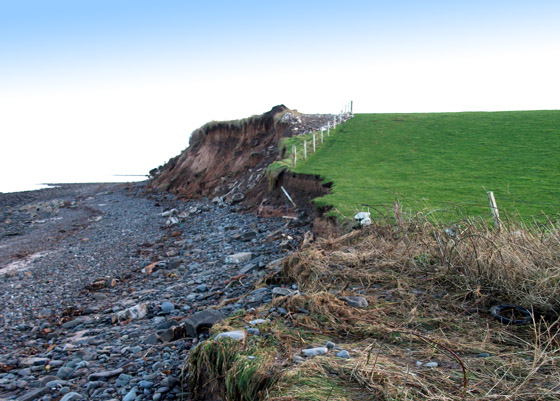
The creators of the Mull of Galloway Trail in southwest Scotland are shocked by the damage caused by a recent January storm. Members of the Stranraer Rotary Club walked the trail – which joined the IAT in May 2013 – to view the impact of the wind and high tides.
Continue reading


