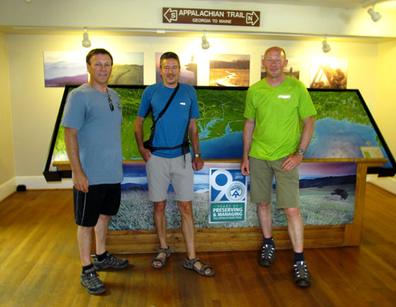
The International Appalachian Trail continues to draw hikers to northern Maine, offering a tour through varied landscapes and a connection to Canada and beyond.
This summer, the Maine chapter is aiming to reroute 52 miles of the trail that currently is set along roadways in southern Aroostook County. About 65 miles of trail are currently set along a road shoulder.
The roughly 13 miles along Grand Lake Road from Matagamon to Shin Pond is actually “good road walking,” with wide shoulders and few trucks, and that will remain a part of the route, Hudson said. For the other 52 miles, the chapter is working with landowners to reroute the trail from Shin Pond to Monticello, aiming to move the trail to old woods roads and all-terrain vehicle trails. A section they’ve secured will run along the south side of Mount Chase, and offer a link to a trail up the 2,440-foot mountain of the same name.
Location of new sectiion of off-road trail
“The idea is in the long-run to get rid of the bulk of the road walking, and to use a combination of woods roads and paths,” including multi-use ATV trails, said Hudson, the former president of the Chewonki Foundation in Wiscasset.
The trail starts at the 601 meter (1972 ft) Slieve League on the Atlantic coast then crosses the Blue Stack Mountains before entering Northern Ireland. It then picks up the Ulster Way and passes the Giant’s Causeway on the stunning northern coastline, before traversing the Glens of Antrim.
The IAT in Ulster~Ireland
After Donegal, the AGM schedule moves to Derry/Londonderry for a pre-AGM tour, followed by the Annual General Meeting in Strabane. The tentative schedule of weeklong activities is:
A list of accommodation is being prepared, and it is hoped that delegates will stay in Castlederg / Derg Valley area of County Tyrone, close to the trail and border with County Donegal. Transport will be provided every day from and to Castlederg, including all trips up to and including the AGM in Strabane. On Friday morning, delegates will be transported to the North East Coast for the weekend’s itinerary.
For more complete visitor information, including transportation links and accommodations list, download the Delegate Information Guide, then go to the IAT Ulster-Ireland website and start planning your visit!
On April 8 & 9, IAT North America held its Annual Spring Council Meeting in Mabou, Nova Scotia, a Gaelic speaking region of Cape Breton.
Duncreigan Inn, Mabou on the IAT Nova Scotia trail route
The two-day event held at Duncreigan Inn was an opportunity for the U.S. and Canadian chapters to gather to discuss common issues and joint initiatives, as well as provide updates on regional and international progress.
Don Hudson discussing IAT Maine
Day One began with a welcome from IAT Nova Scotia hosts Claire MacNeil and John Calder followed by chapter updates, beginning with Maine. Don Hudson discussed a new IAT route through a proposed national forest reserve, the Pioneers of Appalachian/Caledonian Geology website series, as well as opportunities surrounding next year’s ATC Biennial in Maine.
IAT New Brunswick’s Poul Jorgensen discussed his chapter’s new southern route that will connect with IAT Nova Scotia. The route includes sections of the Trans Canada Trail and crosses Stonehammer UNESCO Global Geopark.
Leo Gill of IAT Prince Edward Island discussed the success his chapter has had developing trails across the island, connecting to IAT New Brunswick across the Confederation Bridge in the north and IAT Nova Scotia via the Woods Island ferry in the south.
Claire MacNeil and John Calder described potential IAT routes in Nova Scotia, from the Cape to Cape and Trans Canada Trails linking to New Brunswick and the proposed Sea Wall Trail at the northeastern end of Cape Breton Island.
Paul Wylezol giving an update on the Drifting Apart project
Paul Wylezol of IAT Newfoundland & Labrador completed the chapter updates with a presentation on the IATNL’s plan to develop a UNESCO Global Geopark across the Bay of Islands Ophiolite Complex and commemorate (in 2017) the 250th Anniversary of James Cook’s survey and map of Western Newfoundland, spanning the entire route of the IAT from Port aux Basques in the south to Cape Raven (near the Norse UNESCO World Heritage Site at L’Anse aux Meadows) in the north. He also gave an update on the EU funded Drifting Apart project.
After the chapter updates, representatives posed for the traditional group mugshot before heading to the Mull Cafe and Deli for a well-earned meal and refreshments.
(L-R) Front row: Eric Chouinard, Bill Duffy, Don Hudson, Michael Charles Haynes Back row: Claire MacNeil, Cathy Gill, Leo Gill, Richard Anderson, John Calder, David Williams, Paul Wylezol, Poul Jorgensen and Walter Anderson
The evening session began with a presentation by David Williams on the planned Seawall Trail at the northeastern end of Cape Breton Island, which may become an extension of IAT Nova Scotia. It was followed by a presentation on the Trans Canada Trail in Eastern Canada by trail guide author Michael Haynes.
The last presentation of the day was given by environmentalist Norris Whiston, who gave a presentation on the ecological environment and various plant species found along the IAT Nova Scotia trail route.
Day Two of the meeting was a ‘Nuts and Bolts’ session reserved for common issues and projects, including website and social media, maps and guides, and sponsorship guidelines. Nova Scotia’s John Calder (who is a committee member with the Canadian Geoparks Network) closed out the meeting with a presentation on UNESCO Global Geoparks, including the planned Fundy Rim Geopark in Nova Scotia.
(L-R) IAT Founder Richard Anderson, IAT Nova Scotia’s Claire MacNeil and IAT Quebec’s Eric Chouinard
A special thanks goes out to Claire MacNeil, John Calder and the staff at Duncreigan Inn for for a pleasant and productive IAT North America Council Meeting in Cape Breton.
Thanks also to guest presenters David Williams, Michael Haynes and Norris Whiston for their interesting presentations. Good luck to you all on your various projects.
The 3rd general meeting of Newfoundland’s Cabox Aspiring Geopark was held Friday, March 4 at Memorial University’s Grenfell Campus in Corner Brook, with approximately 40 people in attendance. In addition to updates on the past year’s developments and a review of the upcoming application process, MUN Geologist Andy Kerr gave a special presentation entitled ‘Newfoundland, the Bay of Islands, and the Geological Revolution’.
Geologist Andy Kerr of Memorial University of Newfoundland’s Earth Sciences Department
IAT / Cabox Aspiring Geopark Chairperson Paul Wylezol outlined the GeoSite categories, beginning with five geological groupings: Ancient Continental Slope, Transported Continental Margin, Bay of Islands Ophiolite Complex, Little Port Island Arc Complex, and Carboniferous Cover Rocks of the Deer Lake Basin.
On February 22-23, IAT/Cabox Aspiring Geopark Chairperson Paul Wylezol attended the Geological Association of Canada Regional Technical Meeting at the Johnson Geo Centre in St. John’s, where he gave a presentation on the International Appalachian Trail, UNESCO Global Geoparks and Cabox Aspiring Geopark in Western Newfoundland.
The Spring 2016 Issue of Earth Heritage Magazine features their first story on the International Appalachian Trail. Check out the 45th issue of this “geological and landscape conservation magazine” for a detailed update on how far we’ve come and where we’re headed!
The International Appalachian Trail Newfoundland & Labrador (IATNL) has begun planning trail improvements for 2016, including on the Humber Valley Trail, Grand Codroy Way, and French Shore Trail near Conche, with volunteers Katie Broadhurst and Alex Fortin channeling girl power! They have recently begun developing a plan to increase the local volunteer base, in particular among young adults who appreciate outdoor adventure and physical fitness.
Katie Broadhurst (left) and Alexandra Fortin
They are seeking adventure-loving low-maintenance volunteers to help on popular yet under-maintained scenic trails. There is lots to do, but they know how to get ‘er done and still have fun!
Volunteers Caroline Swan, Arne Helgeland & Katie Broadhurst on the IAT Overfalls Trail, Gros Morne NP
For 2016, volunteer “work” will include trail maintenance, new trail development, back country cabin renovations, and lots and lots of HIKING! The goal is to have one trail enhancement project per month, whether one day local or multi day back country.
Volunteer Alexandra Fortin taking a break on the IAT Overfalls Trail
Plans call for a kick off in May with a gathering of volunteers to review the summer plan, cover basic trail maintenance techniques, and meet all of the fellow volunteers! They will then put it all into action with a little maintenance on the Old Man in the Mountain section of the Humber Valley Trail.
Trail volunteers taking a break by an October fire
A committee of IAT geologists including Walter Anderson, Robert Marvinney, Jim Hibbard, John Calder, and Hugh Barron have established guidelines and selected the first group of deceased honorees who are being recognized for their significant contribution to the understanding of Appalachian/Caledonian geology. Look for the stories of these Pioneers of Appalachian/Caledonian Geology on the IAT website soon!
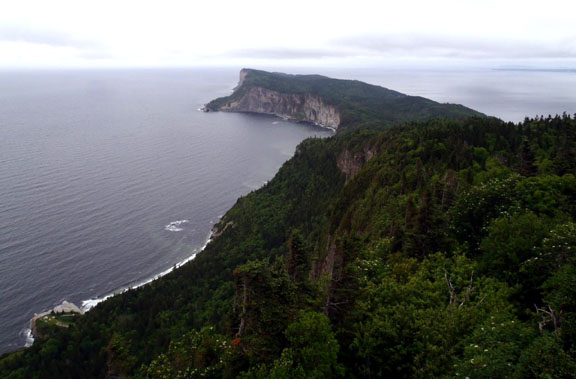
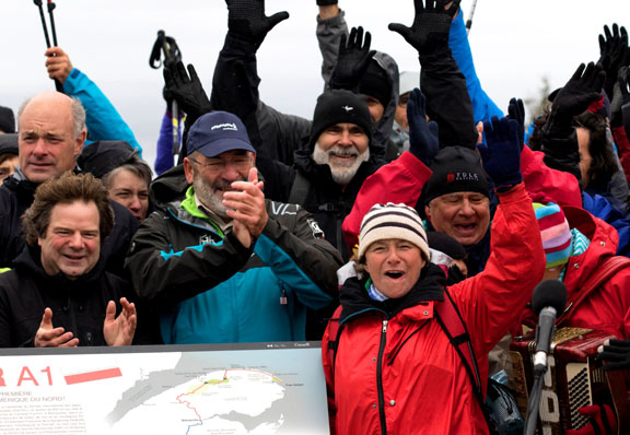
On October 2, the International Appalachian Trail Québec and France’s Fédération Française de la Randonnée Pédestre (FFRP) officially designated IAT Québec (IAT-QC) as North America’s first Grande Randonnée (“Great Hike”) – the GRA1 (America 1) – at Forillon National Park.
The international event took place at Cap Gaspé and marked the closing of the second Traversée de la Gaspésie (TDLG) on Foot (TDLG) on Foot, which ran from September 26 to October 3.
TDLG hikers gather for the GRA1 Launch at Cape Gaspé in Forillon National Park
The GR designation is part of an international strategy aimed at strengthening ties between IAT Québec and the Fédération Française de la Randonnée Pédestre (French Hiking Federation) and promoting hiking in Western Europe and North America.
The FFRP first traveled to Gaspésie with information on the GR program in October 2013. In 2014, IAT Québec was granted GR designation, with permission to use the famous white and red trail markers.
(l-r) Kirk St Peter, Don Hudson, Paul Wylezol and Hugues Deglaire with new GRA1 trail marker
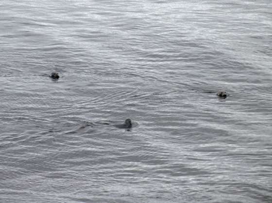
The October 2 Launch was preceded by an IAT/FFRP dinner and refreshments at Brise Bise pub in the town of Gaspé and a morning trek along the coast of Forillon National Park where hikers were treated to about a dozen gray seals who swam in for the celebrations!
These began with music and song along the trail and in the lighthouse shed where approximately 100 hikers gathered for the main event!
Next up was opening introductions and official statements by Parks Canada, IAT, TDLG and RRPF officials followed by the unveiling of a new GRA1 sign to more music and much applause.
IAT Québec’s Eric Chouinard addresses the crowd next to the 1998 SIA-IAT plaque
The bilingual sign describes IAT Québec and the GR® designation and outlines the route on a map of the Gaspé Peninsula.
IAT Québec’s Eric Chouinard and FFRP’s Guy Berçot shake on the new GRA1 designation
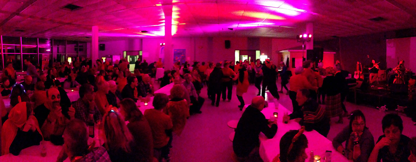
The festivities continued throughout the day, and ended at night with a satanic themed costume party in the town of Gaspé. For more information on IAT Québec and the new GRA1, go to the SIA-IAT website. If you see any devils along the route, touch a trail marker and tell 10 friends they must walk the IAT!!!
Cap Gaspé
(l-r) Eric Chouinard, IAT Québec; Guy Berçot, FFRP; and Claudine Roy, TDLG
(l-r) Hugues Deglaire, Paul Wylezol, Don Hudson, Guy Berçot, Eric Chouinard, Kirk St Peter and Clémence Pepin
Gray Seals
Along the coast of Forillon National Park
Kirk St Peter (IAT Maine), Guy Berçot (FFRP), Paul Wylezol (IAT Newfoundland) and Eric Chouinard (IAT Québec)
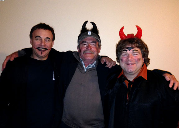
Closing Satanic themed costume party
(L-R) IAT Devils Paul (Newfoundland), Don (Maine) and Eric (Québec)
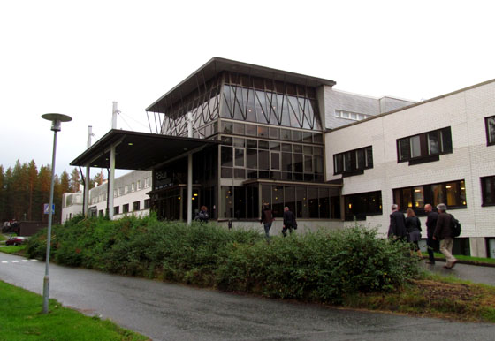
On September 3-5, IAT Chairperson Paul Wylezol attended the European Geoparks Conference in Oulu, Finland, where he gave a presentation on the International Appalachian Trail and its connection to Global Geoparks. The IAT crosses 12 Global Geoparks and Aspiring Geoparks in Canada, Western Europe and Morocco.
The 3-day event was held at the University of Oulu and the nearby Rokua Geopark, and was attended by over 400 representatives from European, Canadian and other Global Geoparks and Aspiring Geoparks.
University of Oulu
Day One began with opening welcome by local officials – including Conference Chair Vesa Krökki – and keynote speeches by Global Geoparks President Professor Nickolas Zouros and UNESCO Representative Dr Margarete Patzak followed by a variety of themed presentations by geopark, tourism and conservation organizations.
2015 European Geoparks Conference Opening Ceremonies
Many focused on the development and maintenance of Global Geoparks while the IAT presentation – entitled International Appalachian Trail partners with European Geoparks – introduced the IAT and its potential connection between Geoparks found along the IAT route, and was given in association with Carlos Neto de Carvalho and IAT partner Naturtejo Geopark of Portugal. Day Two was reserved for field trips to Rokua Geopark or a walking tour of the city of Oulu.
Oulu City Hall
Day Three began with a keynote presentation by Dr Rauno Väisänen, Director of Metsähallitus Parks & Wildlife Finland followed by more presentations on themes such as conservation, education and communication.
Carlos Neto de Carvalho of IAT partner Naturtejo Geopark of Portugal giving a presentation on digital marketing
During coffee and lunch breaks between sessions, participants used the opportunity to view poster presentations and interact with guest presenters and geopark representatives. Day Three ended with a closing dinner at Rokua Health & Spa Hotel where Global Geoparks President Nickolas Zouros announced the results of the 2015 Geopark re-evaluations and welcomed 5 new European Geoparks, bringing the total to 69. He also repeated a Day One prediction that the Global Geoparks Network will receive full UNESCO designation (on par with World Heritage Sites) during the 38th UNESCO General Conference in November, thereby becoming UNESCO Global Geoparks.
On the beautiful morning of August 17, IAT/IATNL Chairperson Paul Wylezol and IATNL Finance Director Kevin Noseworthy set off in a dory from Cox’s Cove, Bay of Islands with Darren Park of Four Seasons Tours in search of Middle Arm geosites for the IATNL planned Cabox Global Geopark.
IATNL’s Kevin Noseworthy (left) and Four Seasons Tours’ Darren Park
The Geopark will feature 3 basic zones of the Humber Arm Allochthon: the Ancient Continental Shelf of North America, the Transported Continental Margin of North America, and the Bay of Islands Complex Ophiolite Massifs.
Bay of Islands detail from the Humber Arm Allochthon. (Geological Survey of Canada)
The tour’s first stop was Middle Arm Point between Humber Arm and Middle Arm. Its exposed and weather-beaten headland is a good example of the Zone 2 Cook’s Brook Formation.
There you can see layers of sedimentary limestone and sandstone folded in unique patterns when tectonic collisions closed the Iapetus Ocean and formed the Appalachian Mountains more than 250 million years ago.
From Middle Arm Point, the trio turned back and headed east into Goose Arm and the rising sun. For more on the story, go to the IATNL website.
On July 17-19, the IAT attended the ATC 2015 Biennial at Shenandoah University in Winchester, Virginia where it gave 3 hours of presentations and distributed information from an extra large conference booth.
Among the 1000+ in attendance were IAT Founder Richard “Dick” Anderson (Maine), IAT Geologist Walter Anderson (Maine), IAT Maine President Don Hudson, IAT Chairperson Paul Wylezol (Newfoundland), IAT Europe Vice President Hugh Barron (BGS, Scotland), UK National Trails Rep Mark Owen (England) and distinguished Appalachian geologist Jim Hibbard from North Carolina State University.
IAT Founder Richard “Dick” Anderson addresses the audience
After registration on Friday, July 17, the conference began with a series of workshop presentations on Saturday morning. IAT Founder Richard “Dick” Anderson opened for the International Appalachian Trail with a review of the early years of the trail’s formation.
Distinguished geologist Jim Hibbard discussing the Appalachian Orogen
Dick was followed by Jim Hibbard who worked with renowned Appalachian geologist Harold “Hank” Williams on his Tectonic Lithofacies Map of the Appalachian Orogen, which he continued to update and digitize until his recent retirement. Jim gave a presentation on Appalachian geology from Georgia to Newfoundland, where Williams created his innovative and colorful maps.
IAT Chairperson Paul Wylezol describing the UN Global Geoparks program and EU Drifting Apart project
Paul then introduced the concept of Global Geoparks as it relates to the IAT and the EU Northern Periphery and Arctic Programme’s Drifting Apart project aimed at “unearthing and strengthening the understanding, appreciation and enjoyment of the fascinating and interconnected geological heritage of the Northern Periphery and Arctic region, and its many links to natural, built and cultural heritage.” It will “support the development of new and aspiring Global Geoparks, promote innovative products and services for social and economic prosperity, and continue to build a strong network of Geoparks in the Northern Periphery and Arctic Region.”
IAT Europe Vice President Hugh Barron of the British Geological Survey – who has helped develop Geoparks in Scotland – gave a more detailed presentation on the European Geoparks program, describing criteria for inclusion and maintenance, and identifying many of the Geoparks along the IAT route in Europe.
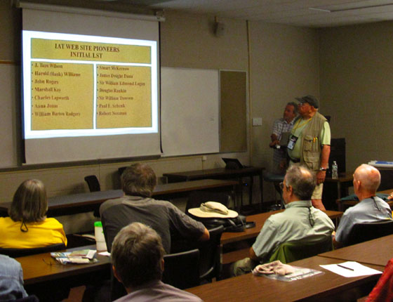
IAT Maine President Don Hudson kicked off the second round of IAT presentations by introducing the IAT’s upcoming Pioneers of Appalachian/Caledonian Geology series. IAT Geologist Walter Anderson followed with a detailed description of the website series and the names of the 15 honourees included in the first round selection. Stay tuned for a special feature on the Pioneers!
South West Coast Path’s Mark Owen introduces Plymouth 2020
Mark Owen of England’s South West Coast Path – hosts of the 2014 IAT AGM – gave a presentation on UK National Trails and a slideshow on his own SWCP. He also introduced Plymouth 400, the celebration planned around the 2020 anniversary of the Mayflower Pilgrims’ voyage to the New World.
The final IAT presentation was by Hugh Barron, who gave an update on IAT Scotland, including the newly launched Firth o Clyde Rotary Trail from the Mull of Galloway in the southwest to Milngavie at the southern end of the West Highland Way near Glasgow. He also discussed a possible new link between IAT Scotland and IAT England.
IAT presenting a copy of the Appalachian Orogen map to AT Museum President Larry Luxenberg
After the presentations, the IAT delegation presented Appalachian Trail Museum President Larry Luxenberg with a copy of the Appalachian Orogen map developed by “Hank” Williams and Jim Hibbard, before shifting to the conference exhibition hall, where the IAT booth showcased its many flags, posters and maps and distributed IAT promotional material.
On Saturday night, the group gathered at a local restaurant for the traditional IAT meal, before retiring back to the hotel for a round or two of well-deserved liquid refreshments.
On Sunday morning, Mark, Hugh and Paul hiked sections of the Appalachian Trail in Shenandoah National Park then visited the ATC Visitor Center in Harper’s Ferry, West Virginia before joining a meeting with ATC Executive Director Ron Tipton and Director of Conservation Laura Belleville.
Ron and Laura were presented with the second copy of the Appalachian Orogen map developed by “Hank” Williams and Jim Hibbard. IAT participation in the week-long 2015 Biennial came to an end Sunday evening, July 19, but not before two productive days of promoting the International Appalachian Trail and networking with ATC hikers and officials.
Many thanks go out to the Appalachian Trail Conservancy and their members for making the IAT feel at home. We hope to return the favour some day and look forward to participating in the ATC 2017 Biennial near the end of the AT – and beginning of the IAT – at Mount Katahdin, Maine!
(l-r) Paul Wylezol, Hugh Barron and Mark Owen at the AT Museum in Harper’s Ferry
(l-r) Walter Anderson, AT Museum President Larry Luxenberg, Hugh Barron, Dick Anderson, Don Hudson, Jim Hibbard, Mark Owen and Paul Wylezol
IAT Geologist Walter Anderson names the first 15 Legends of Appalachian/Caledonian Geology
(l-r) Paul Wylezol, Dick Anderson, Don Hudson, Bill O’Brien (ALDHA Newsletter Editor), Mark Owen, Hawk Metheny, Jim Hibbard and Hugh Barron
(l-r) Mark Owen, Paul Wylezol, Walter Anderson, Dick Anderson, Jim Hibbard, Don Hudson and Hugh Barron
Mark and Hugh at Appalachian Trail marker in Shenandoah National Park
In July 2015, the International Appalachian Trail crossed the Mediterranean Sea from Spain into Morocco. The addition of the African country marks the third and final continent of IAT expansion beyond borders to all “Appalachian” regions once connected on the super-continent Pangea more than 250 million years ago, when the Appalachians, Caledonians, and Anti Atlas Mountains were formed.
The first phase of IAT Morocco will extend approximately 600 kms from Midelt to Taroudant and be divided into 3 sections – Midelt to Megdaz, Megdaz to Imlil (High Atlas Central), and Imlil to Tagmout (near Taroudant) – taking a combined 40+ days to complete on foot.
Map of IAT Morocco
Along the way, hikers will experience geography, culture and religious traditions unlike anything previously experienced along the IAT, from deserts to Berbers to the Muslim call to prayer.
Berber guide holding the IAT Morocco blaze
Highlights include Jebel Ayachi (the highest peak in the middle Atlas), 700m high Tatrout gorge, the famous Plateau Lakes and fortified cliffside village of Irherm n’ Ouchtim, the ridge of Mgoun (the second highest peak in North Africa) and Megdez, arguably the most beautiful village in the Atlas Mountains.
Red earth houses of Megdez
Next up are Anghomer Pass (Tizi n’Timlilt, 3100m) and the tremendous views of Ouazarzate and Jebel Sahro range, Ardrar Mahboub with its superb views south towards the Sahara, Yagour Plateau (well-known for rock carvings), and Mount Toubkal, at 4167m, the highest peak in the High Atlas and North Africa.
Red earth houses of Megdez
Others include the Sultan’s Kasbah Gandafa Palace (17th century), Tinmal Mosque (12th century), Jebel Imaradene summit, and the plateau of a thousand peaks.
Tinmal Mosque
The IAT Morocco blaze (i.e., trail marker) contains the familiar IAT/SIA layout, with the addition of the country’s flag on top and IAT QR code at bottom.
Blazes are currently being installed along the route, with the assistance of IAT partner Morocco Trek and local volunteers. Hikers looking for assistance in finding the route and planning their IAT Morocco adventure can contact Morocco Trek at http://www.moroccotrek.co.uk/.
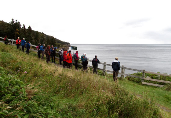
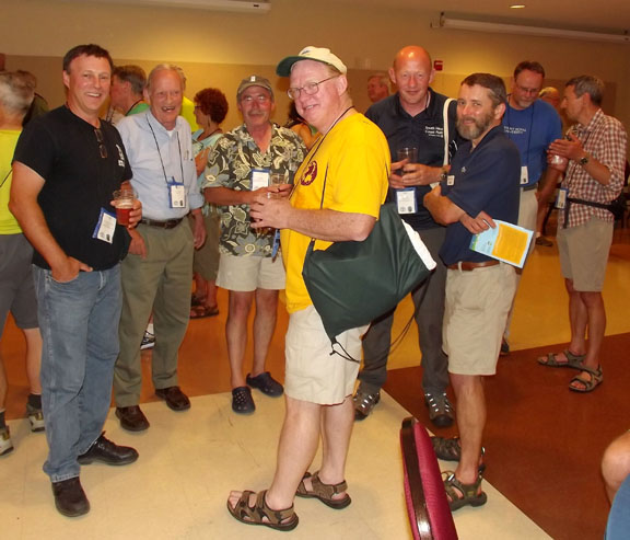
The 21st annual meeting of the Maine Chapter of the International Appalachian Trail was held between Thursday, May 14th and Saturday, May 16th at Shin Pond Village. A dozen members gathered at the Lumberman’s Museum in Patten at 3:00 p.m. Thursday afternoon for a tour of the facility with Executive Director Rhonda Brophy, before heading for refreshments and dinner at Shin Pond Village. The IAT in Nova Scotia has a new advocate in Claire MacNeil, who traveled all the way from Cape Breton to attend the annual meeting in Maine.
Group photo of the Maine IAT Chapter at Shin Pond
Julie King provided the Thursday evening program, a photographic review of “Side Trails along the IAT”, which captured the highlights of her hike on the IAT in Maine and Canada with fellow long distance hiker Ed Talone during the summer and fall of 2013. In addition to exploring trails along the east coast of New Brunswick from Campbellton to the foot of the Confederation Bridge near Sackville, Julie and Ed added the Magdalene Islands and the Cabot Trail on Cape Breton to their walk on the IAT. A ferry from PEI took them to the Magdalene Islands, where spectacular beaches and low rolling hills grace the Gulf of St. Lawrence. Back on the IAT in Nova Scotia, Julie and Ed decided to add the Cabot Trail to their hike. They met Claire near the start of the trail as they walked right by her house. It is safe to say that this chance and serendipitous encounter bodes well for the IAT in Canada. Claire has become a strong champion for the IAT within Hike Nova Scotia. Once in Newfoundland, Julie and Ed flip-flopped from Port au Basque to St. Anthony in order to walk south with the onset of fall weather. However, a few miles into their walk south, they decided to take a short ferry to the Labrador coast where they walked the Pioneer Footpath on Appalachian terrane between L’Anse au Clair and Pinware to Red Bay.
At the end of her fine presentation, Dick Anderson invited Ed to join Julie at the front of the room and presented them both with IAT Maine’s first Trailblazer Awards to commemorate their walk on the IAT in North America.
Julie King and Ed Talone are presented their awards by Dick Anderson
The crowd swelled on Saturday morning to hear a full program of presentations, including an update of activities and work in Baxter State Park by Park Naturalist Jean Hoekwater. An effort to re-route the Abol Trail from the bottom of the slide to safer ground to the west and north will require an additional trail crew, and will be funded in part through a special contribution made by a long-time friend of the park. Susan Adams of Katahdin Woods & Waters and Karin Tilberg of the Forest Society of Maine also provided updates of their work. As the impact of mill closures and declining populations is felt in the Millinocket and Greenville areas, both communities are exploring the role that the forests, rivers and trails can play in the future. In their own ways, Katahdin Woods & Waters and the Forest Society of Maine are proving to be great partners.
Baxter State Park by Park Naturalist Jean Hoekwater
For more on the story, go to the IAT Maine Chapter website.
On a sunny Saturday, May 9, 2015, Sally Magnusson, broadcaster, top news presenter for BBC Scotland, writer and journalist, officially opened the 161-mile (266km) Firth o Clyde Rotary Trail in Milngavie – next to the start of the West Highland Way – in front of members of the public, the Rotary Clubs of Stranraer, Ayr, Gourock, Allander, and their guests – including IAT Europe vice-president Hugh Barron representing IAT Scotland.
Sally Magnusson addresses audience at FoCRT Launch
Rotary could not have chosen a better person for the job, as Sally’s late father was the celebrated Icelander Magnus Magnusson, presenter of the BBC “Mastermind” Quiz Show, one-time President of Scottish Natural Heritage, and also the “Paths For All” Charity who encourage local footpath development and healthy exercise.
Sally Magnusson unveils the new FoCRT Plaque at Milngavie
Plaque at Milngavie Introduced by her host, Iain White (Allander and the new Clyde Coastal Path), Sally unveiled two commemorative plaques – one of which had been carried in relay by teams of Rotarians to Milngavie all the way from the Mull of Galloway (to where it will return). A keen walker herself, she duly declared – ‘Scotland is rich in beautiful places to walk, but for me there is nothing better than a coastal path, and I look forward to walking this one’.
Members of the plaque relay team at Irvine Harbourside
Tom Stevenson (Stranraer and the Mull of Galloway Trail) then presented her with a cheque for £1000 for her charity in memory of her late mother Maimie, also a famous journalist – ‘Playlist for Life’ (providing favourite music for dementia sufferers’ on iPod).
(L-R) Tom Stevenson, Jimmy Begg, John Waddle (District Governor Rotary), Sally Magnussen and Iain White
In thanking Sally, Jimmy Begg (Ayr and the Ayrshire Coastal Path) said this occasion was the realisation of an eleven-year aspiration; and paid tribute to the huge amount of work undertaken – firstly by members of Ayr Rotary Club in creating the Ayrshire Coastal Path in 2008, and then to the members of Stranraer Rotary Club who rose to the challenge to connect up the Mull of Galloway in 2012 – and to Gourock and Allander Rotary Clubs, who did likewise with the final link, the Clyde Coastal Path in 2015.
Jimmy Begg addressing the crowd
He also thanked Scottish Natural Heritage and Visit Scotland for the accolade of Scotland’s Great Trail awarded to both the ACP and the MGT, and made special mention of the excitement and pleasure they’d felt away back in Oct 2010, when the International Appalachian Trail invited the ACP (and subsequently the MGT and CCP trails) to become part of IAT Scotland, forming a vital link with Ireland and the West Highland Way.
Milngavie Pipe Band
Now complete, the Firth o Clyde Rotary Trail (FoCRT) will prove a major asset to the Scottish walking tourism industry, linking as it does with a number of existing long-distance routes in Scotland. The tough/gentle nature of the trail should encourage everyone – from families on a day out to serious walkers – to take to the outdoors, and enjoy the stunning scenery and superb natural environment.
FoCRT comprises three autonomous long distance trails, the Ayrshire Coastal Path (2008), the Mull of Galloway Trail (2012) and the Clyde Coastal Path (2015), created by the Rotary Clubs of Ayr, Stranraer, and Allander and Gourock, respectively.
Ailsa Craig and Culzean Bay – Firth o Clyde at its bonniest!
The Mull of Galloway Trail (36 miles/60km) starts at the Mull Lighthouse, perched on steep cliffs at the southernmost point in Scotland, with fine prospects of the Isle of Man and Ireland’s Mountains of Mourne, before travelling up the sheltered eastern shore of the Rhinns, with big sky views over Luce Bay to the Machars and the distant Galloway Hills. Passing through rich farmland, it crosses the Southern Upland Way near Stranraer, then follows the Coastal Path along Loch Ryan, with its fascinating smuggling, WW2, and rich ancient history. From Cairnryan it climbs on to high moorland with magnificent views of loch, sea, and hills, before the descent to Glenapp.
Cotton Joe Norman, first long distance hiker to complete IAT Scotland, walking the Mull of Galloway Trail in 2013
From Glenapp to Skelmorlie, the Ayrshire Coastal Path runs for 100 miles (161km) along one of Britain’s finest panoramic coastlines, with iconic Ailsa Craig and Arran always in the frame. Walkers, will tramp the native heath of Scotland’s three greatest heroes – Robert Burns, King Robert the Bruce and Sir William Wallace – over a land steeped in history, and teeming with wildlife. Firstly, along wild cliff-top tracks, old turnpike roads and rough and sandy beaches; past ruined castles and small fishing villages – by the Open Championship golf course at Turnberry and through the grounds of Culzean Castle. From Ayr northwards, the going is much gentler along sandy beaches past Prestwick – the birthplace of Open championship golf – and its successor, Royal Troon, From Ardrossan to Largs, sailing yachts now glide calm seas once scoured by fearsome Viking longships.
IAT officials hike past Culzean Castle following the 2013 IAT Annual General Meeting
The Clyde Coastal Path (27 miles/45km) provides low and high-level routes to Greenock from the north end of the ACP at Wemyss Bay, then over the Erskine Bridge to the start of the West Highland Way at Milngavie. The Low Road has easy walking from Wemyss Bay along Ardgowan shore and the quayside promenades of Gourock, Greenock and Port Glasgow. Serious walkers on the High Road along the Kelly and Greenock Cuts, have superb views of the Clyde Estuary and distant Highland hills. Over the Erskine Bridge, the route follows part of the Roman Antonine Wall, then rises over Douglas Muir – with great panoramic views of Glasgow and the Clyde – before descending to Milngavie.
View from the Clyde Coastal Path
The International Appalachian Trail Scotland Route – and links south and west:
Having now completed the Firth o Clyde Rotary Trail (161 miles) from Mull of Galloway in the south-west, the intrepid walker will now take the iconic West Highland Way (96 miles) from Milngavie to Fort William, then tramp along part of the Great Glen Way, before joining the unmarked Cape Wrath Trail, which traverses 200 miles of magnificent wilderness to finally reach another spectacular lighthouse over towering cliffs at Scotland’s most north-westerly point.
Map of IAT Scotland
As part of the International Appalachian Trail Scotland, looking to the west and south, FOCRT forms a strategic link with IAT Ireland – and potentially England – and is set to play an increasingly important part in the development of South West Scotland’s walking tourism.
NB. FoCRT is the umbrella title for the first section of the International Appalachian Trail Scotland, and its website (www.focrt.org) should simply be used to fast-link to the websites of its three constituent paths, from which walkers can gather all the info needed to plan their route.
On April 24 & 25, IAT chapters from Maine to Newfoundland gathered in Moncton, New Brunswick for the annual IAT North America Council Meeting. The two-day event included presentations on chapter progress, updates on IAT news, discussion of joint projects, and participation in the July, 2015 ATC Biennial in Winchester, Virginia.
IAT Maine President Don Hudson giving an update
IAT Maine President Don Hudson led off the chapter presentations with an update on progress in Maine, including plans for a side trail to Shin Pond Sugarloaf, which contains a large brachiopod fossil deposit. He was followed by New Brunswick’s Poul Jorgensen who gave a presentation on his chapter’s new southern route that will traverse Stonehammer Geopark before following the coastline of the Bay of Fundy and connecting to both the Confederation Bridge to Prince Edward Island and the border with Nova Scotia.
Poul Jorgensen (third from left) giving a presentation on the southern New Brunswick route
After Prince Edward Island’s Leo Gill gave an update on PEI – including new trail maps and brochures – and Eric Chouinard discussed weather related issues and GR progress in Quebec, IAT Nova Scotia’s Claire MacNeil reported renewed enthusiasm and interest in her province. After the meeting on Saturday morning, she and IAT Chair Paul Wylezol raced off to Scotsburn, NS to attend the Nova Scotia Hiking Summit, where Paul gave a presentation on the mission and progress of the IAT.
Claire MacNeil gives an update on IAT Nova Scotia, while New Brunswick Tourism Rep Carl Lavigne looks on
During the council meeting, Paul reviewed plans for Cabox Geopark in Western Newfoundland, spanning the Bay of Islands Ophiolites from Lewis Hills to Tablelands. It will include the 6-9 day IAT UltramaTrex across the rust-colored ultramafic mantle. Will Richard then gave a presentation on IAT Greenland, from the southern sub-chapter of Erik the Red Land to the northern sub-chapter on the Nuussuaq Peninsula.
Will Richard giving a presentation on IAT Greenland
The first day of meetings ended with IAT Geologist Walter Anderson giving a presentation and leading a discussion on the upcoming Pioneers of Appalachian Caledonian Geology website series.
The series will pay tribute to geologists and scientists who made contributions to the understanding of the Appalachian and Caledonian Mountains, formed by tectonic collisions that created the super-continent Pangea during the closing of the Iapetus Ocean.
IAT Geologist Walter Anderson discussing the Pioneers website series
In addition to laying the trail’s foundation, geology is becoming more important to the IAT, as geoheritage, geoparks and geotourism grow in popularity.
(Left to right) Eric Chouinard, Don Hudson, Dick Anderson and Sheila Walters
The first day of meetings ended with the customary refreshments and discussion at IAT Founder Richard “Dick” Anderson’s room, followed by dinner – and more refreshments – at Maverick’s Steakhouse & Grill. The second day of meetings focused on websites and social media, before closing with a discussion on IAT participation in the July 2015 ATC Biennial in Winchester, Virginia.
Paul and Claire then left for Scotsburn, NS to attend the Nova Scotia Hiking Summit. The Hike Nova Scotia sponsored event was a celebration of hiking culture and best practices, and provided networking opportunities for the approximately 100 participants. IAT Nova Scotia had a booth set up where they promoted the International Appalachian Trail and sold tickets on a 50-50 fundraiser draw, later selected by Hike Nova Scotia President Garnet McLaughlin. Paul gave a slideshow presentation on the IAT (prepared by Maine’s Don Hudson) and later spoke with Tourism and Hike Nova Scotia officials.
(Left to right) Paul Wylezol, Chairperson IAT, Heather Yule, Nova Scotia Tourism Agency Representative, Claire MacNeil, Director IAT Nova Scotia, and Garnet McLaughlin, President of Hike Nova Scotia
A special thanks goes out to Poul Jorgensen and his IAT NB Trails squad for hosting the North America Council Meeting in Moncton, and to Hike Nova Scotia for opening the door to the IAT in Scotsburn! May the hiking gods shine on you in 2015!
As the name suggests, the International Appalachian Trail winds its way across sections of North America’s Appalachian Mountains, before crossing the Atlantic Ocean and following other Pangea related mountains of Western Europe and North Africa. Though the mountains themselves were formed over 250 million years ago when continental plates collided, what is the origin of the name “Appalachian”, the fourth oldest surviving European place name in the United States?
Our story begins with Christopher Columbus (c.1450-1506), an Italian merchant and navigator from Genoa who sought financial support for a westward voyage across the Atlantic Ocean in search of the East Indies.
Christopher Columbus, posthumous portrait by Sebastiano del Piombo, 1519
Columbus was inspired by The Travels of Marco Polo and the ideas of Florentine astronomer Paolo dal Pozzo Toscanelli who theorized that sailing west across the Atlantic Ocean would be a more expedient way to reach the riches of the east.
Toscanelli from the monument to Columbus, Vespucci and Toscanelli in the Basilica di Santa Croce in Florence
After twice being rejected by King John II of Portugal (who, after the successful voyage of Bartholomew Diaz around the Cape of Good Hope in 1488, already had a sea route east), Columbus succeeded in receiving support from Spanish Monarchs Isabella I of Castile and Ferdinand II of Aragon.
Queen Isabella I of Castile and King Ferdinand II of Aragon
On August 3, 1492, Columbus set sail from Palos de la Frontera, Spain on his first of four voyages west across the Atlantic Ocean.
Columbus’ three ships: the Niña, the Santa Maria, and the Pinta
After resupplying at Castille’s Canary Islands off the west coast of Africa, he departed September 6 on what would be a 5-week voyage to the Bahama Islands, first sighting land on October 12.
Christopher Columbus Discovers the Americas for Spain, by John Vanderlyn
Within 10 years and after 3 more voyages, Columbus had explored most of the Caribbean and the east coast of Central America, where he was told by natives of another ocean to the west.
Christopher Columbus’ Four Voyages, 1492-1504
It was Spanish explorer and conquistador Vasco Núñez de Balboa (c.1475-1519), who in 1513, crossed the Isthmus of Panama and became the first European to reach the Pacific Ocean from the New World.
Fellow conquistador Juan Ponce de León (1474-1521) joined Columbus on his second voyage in 1493, and after serving as the first governor of Puerto Rico (1509-1511), set out on March 4, 1513 to search for new lands rumored to be to the north. On April 2 during the Easter Season (which the Spaniards called Pascua Florida – Festival of Flowers), he sighted a verdant landscape on the east coast of Florida, which he named La Florida.
Fifteen years later, in April, 1528, Conquistador Pánfilo de Narváez and a fleet of 5 ships arrived on the west coast of Florida near what is now Tampa Bay. With 300 men, he landed and marched north through the interior in search of gold and other riches, until they reached a Native American village near present-day Tallahassee, whose name they transcribed as Apalchen or Apalachen.
Native Americans in Florida, 1591, by Theodor de Bry
Encountering hostility from the natives, they retreated to the coast where Narváez was swept out to see on a raft and never seen again. After eight years and many ordeals, only 4 survivors lived to reach Spanish forces in Mexico. In the years that followed, the names Apalchen and Apalachee were used to describe the Florida tribe and interior region to the north.
The Diego Gutiérrez map of the New World (above and below) entitled Americae Sive Quartae Orbis Partis Nova Et Exactissima Descriptio was printed in 1562 and was the first to record the names “Apalchen” (or a derivative) and “California”. It was printed in Antwerp for the Casa de Contratación, the Spanish government agency which attempted to control all Spanish exploration and colonization.
Diego Gutiérrez’s Americae Sive Quartae Orbis Partis Nova Et Exactissima Descriptio, 1562
In 1539, explorer and conquistador Hernando de Soto led an expedition of 620 men and 220 horses deep into what is now Florida, Georgia, the Carolinas, Tennessee, Alabama and possibly Arkansas. He was fascinated by the stories of Cabeza de Vaca, one of the four survivors of the 1527-1536 Narváez expedition. With the help of Spaniard Juan Ortiz who was found living with the native Mocoso, de Soto recruited a series of local guides who were able to communicate with neighbouring tribes, thus acquiring local knowledge of the regions he crossed.
De Soto, from Retratos de los Españoles Illustres con un Epítome de sus Vidas, Madrid, Imprenta real, 1791
The expedition spent its first winter at Anhaica, capital of the Apalachee. The following year it journeyed northeast through Georgia, South Carolina (where de Soto was received by female chief Cofitachequi) and North Carolina (where the men spent a month searching for gold in the Appalachian Mountains), before turning west and south into Tennessee, Georgia and Alabama.
Native Americans searching for gold in a stream, by Theodor de Bry, 1591
The following year the expedition headed west and reached the Mississippi River, where in May 1542, de Soto died of fever. His men continued on under the command of Luis de Moscoso Alvarado and reached Texas, before turning back and sailing down the Mississippi to the Gulf Coast.
Though the De Soto expedition failed to find riches or establish a colony, it did contribute greatly to European knowledge of the geography, biology and ethnology of the land known as Florida. French artist and cartographer Jacques le Moyne de Morgues used it in his 1565 map of Florida, which was the first to use “Apalachee”, or the Latin “Apalatci”, to refer to the Appalachian Mountains.
De Bry and Le Moyne Map of Florida and Cuba, 1591
Before long the entire southeast north of Florida – which itself spanned all of the southeast – became known as the land of Apalche, or Apalachee. The mountains to the north became known as the Allegheny Mountains, purportedly derived from the Lenape word for ‘fine river’.
Corneille Wytfliet map of “Florida” and “Apalche”, 1597
In 1569, Flemish cartographer Gerardus Mercator completed a world map entitled Nova et Aucta Orbis Terrae Descriptio ad Usum Navigantium Emendate Accommodata, which was the first to show the Appalachian Mountains as a continuous mountain range stretching along the east coast of North America. It was also the first map to use the Mercator projection, whereby lines of constant compass bearing are straight lines on the map.
Appalachian Mountain detail from Gerardus Mercator’s World Map, 1569
By the 19th century, both “Appalachian” and “Allegheny” were applied to the entire length of the eastern mountain system, replacing numerous more localized names such as Endless, Black and Smoky mountains. “Appalachian” became favored for the whole system following the publication of A.H. Guyot’s study On the Appalachian Mountain System in 1861, which is credited with securing scientific usage of “Appalachian”, and eventually leading to the popular endorsement of the term (Stewart, 1945).
Approaching the Allegheny Mountains, North Carolina, by Joshua Shaw (1777-1860)
In an ironic twist to the Appalachian story, the Conquistador Hernando de Soto was born in 1496 in Extremadura, Spain, near the country’s Appalachian mountain cousins … y El Sendero Internacional de los Apalaches!
In 1498, just one year after Italian explorer Giovanni Caboto rediscovered North America and six years after fellow Italian Christopher Columbus “discovered” the New World, Portuguese explorers João Fernandes Lavrador and Pêro de Barcelos were the first modern explorers of much of northeastern North America, including the Labrador Peninsula. They were followed (1500-02) by Portuguese explorers Gaspar and Miguel Corte Real. This is the story of Portuguese exploration of North America, the fourth in the IAT Natural and Cultural Heritage Series.
View of Lisbon, 1572, Braun and Hogenberg
In 1295, when Italian merchant Marco Polo returned to his native Venice after 24 years travelling across Asia to China with his father Niccolò and uncle Maffeo, few Europeans had any knowledge of lands beyond the Near East, where four years earlier, 200 years of Christian military campaigns to the Holy Land known as the Crusades had ended.
Marco Polo Wearing Tatar Outfit
However the Polos returned at a time when Venice was at war with Genoa, another wealthy Italian city-state with an extensive Mediterranean trading network. After outfitting a galley for war, he was soon captured and imprisoned for approximately 3 years, during which time he dictated a detailed account of his travels to fellow prisoner Rustichello da Pisa, who after adding his and other tales, published a book with the English title The Travels of Marco Polo.
Handwritten notes by Genoan explorer Christopher Columbus on his Latin copy of The Travels of Marco Polo
Though written before the invention of Gutenberg’s printing press (c. 1439), the book was widely copied in many languages, inspiring merchants, seamen and nobility with tales of riches in the far east. Already experienced traders in the eastern Mediterranean, Italian city-states were well positioned to capitalize on increased trade with Arab and Turkish middlemen.
Fra Mauro Map, c. 1450, with south at top, inspired by The Travels of Marco Polo
However in the early 15th century, another bold and visionary European had another idea. He would pursue trade directly with the far east, avoiding non-Christian middlemen. Portugal’s Infante Dom Henrique de Avis, Duke of Viseu, better known in the 20th century as Henry the Navigator (1394-1460), would devise a plan to reach Asia by sailing around Africa, from the Atlantic to Indian Ocean.
15th Century Portuguese Prince, Henry the Navigator
In 1415 at the age of 21, Henry convinced his father, King John I, to conquer the port of Ceuta on the North African coast. This Moorish stronghold in the Strait of Gibraltar had long been used as a base for Barbary pirates who raided the Portuguese coast, capturing locals and selling them in the African slave market. Soon after, he was exploring the West African coast, hunting pirates and seeking the source of the area’s lucrative gold trade and the legendary Christian Kingdom of Prester John.
14th century Catalan map showing Mansa Musa, king of Timbuktu, holding a golden nugget
Because Mediterranean ships of the era were too slow and heavy for these dangerous forays into the Atlantic Ocean, a new and much lighter ship was developed that was faster and more maneuverable. Rigged with 2 or 3 lateen sails, these shallow-keeled Portuguese caravels of 50 to 150 tons were able to tack against the wind and sail upriver into shallow coastal waters.
16th century Portuguese Caravel
Soon Henry’s explorers were discovering new lands in the eastern Atlantic, including the Madeira Islands (1420) and Azores (1430), which were quickly colonized. They also discovered the volta do mar (Portuguese for “turn of the sea“), the navigational technique whereby mariners returning to Portugal from the west coast of Africa had to follow the clockwise currents and trade winds and sail northwest to reach northeast. This was a major innovation in Atlantic navigation that would play a major role in future exploration. By the time of Henry’s death in 1460, Portuguese caravels had discovered the Cape Verde Archipelago and circumvented the Muslin land-based trade routes across the western Sahara Desert, thus enabling direct trade for gold and slaves.
Map of West Africa by Luis Lázaro (1563) showing volta do mar
During the generation that followed, Portuguese explorers continued south along the west coast of Africa until 1488 when Bartolomeu Dias sailed around the southernmost tip of the continent, becoming the first European to reach the Indian Ocean from the Atlantic. Four years later in 1492, Christopher Columbus followed the volta do mar on his first voyage west across the Atlantic Ocean in search of the East Indies.
Christopher Columbus, posthumous portrait by Sebastiano del Piombo, 1519
On October 12 he landed on a Bahamian Island which he claimed for supporting monarchs Ferdinand II of Aragon and Isabella I of Castile, after being rejected by King John II of Portugal on the basis that his estimated travel distance of 2400 miles was far too low and Diaz had already rounded the “Cape of Good Hope” for an eastern maritime route to Asia.
“Columbus Map”, c. 1493 from the Lisbon workshop of Bartolomeo and Christopher Columbus
This new discovery precipitated a dispute between Spain and Portugal, which had been granted all lands south of the Canary Islands in the Alcaçovas Treaty of 1479, which ended the War of the Castilian Succession (1475-1479). The dispute was resolved by the Treaty of Tordesillas in 1494, which divided all new lands in the Atlantic Ocean between the Portuguese and Spanish empires along a meridian 370 leagues west of the Cape Verde Islands, approximately halfway between those islands and the islands discovered by Columbus in 1492. Lands to the west of the meridian would belong to Spain, while lands to the east would belong to Portugal.
1494 Treaty of Tordesillas between Portugal and Spain
In just three years, Venetian Giovanni Caboto became the first European to reach Newfoundland in North America since the Norse Greenlanders, approximately 500 years earlier. Sailing with a royal patent from England to find a northwest route to the East Indies, his discovery would complicate future Portuguese and Spanish claims to the New World.
John Cabot departing Bristol, England in 1497, by Earnest Board
That same year, Vasco da Gama departed Portugal for India, following Diaz’s route south into the Indian Ocean, where in 1498 he became the first European to reach India by sea. Two years later, countryman Pedro Álvares Cabral followed the counter clockwise ocean currents and trade winds of the South Atlantic on his voyage to India, and in the process discovered the northeast coast of South America, claiming the future “Brazil” for Portugal.
While Cabral was exploring the southwest Atlantic, Portuguese explorer Gaspar Corte-Real and his brother Miguel were exploring the northwest and reached what is believed to be Newfoundland. Though Miguel returned to Portugal with two of the expedition’s three ships, Gaspar continued southwards and was never heard from again. Miguel met the same fate the following year, when he set off in search of his younger brother. As a result of these voyages the names Terra Cortereal and Terra del Rey de Portuguall began to appear on European maps of the day.
Cantino Planisphere (1502) showing Brazil and Newfoundland east of the Tordesillas Meridian
The Corte Reals were following in the wake of fellow Azores countryman João Fernandes Lavrador, who in 1498 was granted a patent by Portuguese King Manuel I to search for new lands on the Portuguese side of the Tordesillas Meridian. He reached Greenland and Labrador, named Island of Labrador and Land of Labrador, respectively, and was granted title to many of the lands he discovered. In 1501, he too was lost at sea in the North Atlantic.
Pedro Reinel Map (1504) showing (top left) Labrador, Newfoundland and Cape Breton
The Portuguese Pedro Reinel Map of 1504, the world’s first to include lines of latitude, clearly shows the Canadian regions of Labrador, Newfoundland and Cape Breton, as well as the Strait of Belle Isle and Cabot Strait.
500 years earlier, the coast of Labrador and Strait of Belle Isle were familiar to Norse explorers from Greenland, beginning with Leif Erikson who established the settlement of Vinland at the tip of Newfoundland’s Great Northern Peninsula.
16th century Skálholt Map of Norse America identifying Promontorium Winlandiae
In 1534 and 1535, Jacques Cartier entered the Gulf of St. Lawrence via the Strait of Belle Isle during his first two voyages of discovery. In 1536 after overwintering in “Canada”, he returned to France via the Cabot Strait, thus becoming the first European on record to determine Newfoundland to be one or more islands.
Though the first French explorer of “Canada”, Cartier was not the first explorer flying the French flag in North America. in 1524, Florentine Giovanni da Verrazzano explored the east coast from North Carolina to Newfoundland in the service of King Francis I.
Nicolas Vallard Map of eastern North America, 1547, with south at top
For the next half century, the Strait of Belle Isle continued to establish itself as Canada’s Heritage Gateway, when whaling fleets from the Basque region of France and Spain (whose King Phillip II was also crowned Philip I of Portugal in 1581) hunted right and bowhead whales as they migrated through the strait between the Gulf of St. Lawrence and Labrador Sea.
Woodcut from the ‘Cosmographic Universelle’ of Thevet, in folio Paris, 1574
In spite of the Portuguese claim to North America under the Treaty of Tordesillas and the voyages of João Fernandes Lavrador and Gaspar Corte-Real, Giovanni Caboto’s discovery of Newfoundland on behalf of King Henry VII of England one year before Lavrador’s voyage in 1498 established “British title to the territory composing [Canada and] the United States. That title was founded on the right of discovery, a right which was held among the European nations a just and sufficient foundation, on which to rest their respective claims to the American continent. Whatever controversies existed among them (and they were numerous), respecting the extent of their own acquisitions abroad, they appealed to this as the ultimate fact, by which their various and conflicting claims were to be adjusted.” (Commentaries on the Constitution of the United States, by Joseph Story, LL. D, U.S. Supreme Court Justice, and Dane Professor of Law, Harvard University, 1833).
Sir Humphrey Gilbert claiming Newfoundland for England in 1583 in the name of Queen Elizabeth I
The English claim to North America was disputed by its historic rival France, based on the voyages of Jacques Cartier who discovered the St. Lawrence River and the interior of “Canada”. After the English victory in the Seven Years War (French and Indian War in North America, 1754-1763), England finally gained possession of the continent and quickly employed James Cook to survey and chart the Strait of Belle Isle and French Shore of Newfoundland, which together with the islands of St. Pierre and Miquelon, were the only remaining territories under limited French control.
French version of James Cook’s Map of the Strait of Belle Isle, 1784
The victory was short lived. Twenty years later, England lost the southern half to the American States during the Revolutionary War for independence.
As for Portugal, they continue to fish in Newfoundland waters, an enduring tradition lasting over 500 years. In Labrador, one of the biggest employers today is the mining company Vale, a Portuguese language multinational based in the Tordesillas Meridiancountry of Brazil.
Statue of Gaspar Corte Real on the grounds of the Newfoundland Legislature, St. John’s
And in Portugal, the country proudly remembers their classic age of exploration, a time when their country was without equal on the high seas.
One side of the Padrão dos Descobrimentos (Monument of Discoveries) in Lisbon, Portugal
IAT Founder Dick Anderson presents Walter with his cake while Walter’s daughter Ruth and wife Ann look on
Family and friends gathered at the Muddy Rudder Restaurant in Yarmouth, Maine on Thursday, February 27, to wish IAT Chief Geologist Walter Anderson a happy 85th birthday and announce the new Walter Anderson Endowment Fund. Fellow geologists and colleagues on the IAT Maine Chapter board noted Walter’s long career as the Maine State Geologist. Under his direction, maps of the state’s bedrock and surficial geology were updated and a new map of the state’s water aquifer resources was created. Walter also introduced geographic information systems mapping to Maine as part of the process to determine Maine’s suitability to host a deep geologic repository for high level radioactive waste. The answer was “No!”
Chapter President Don Hudson presents Walter with a gift and announces the Walter Anderson Endowment Fund
Walter joined the board of the Maine Chapter of the IAT in 2004 and developed the first maps of the trail in Maine, New Brunswick, Quebec and Newfoundland. From his first days on the board, Walter emphasized the importance of geology to the story of the trail. When a couple of Scottish geologists attended a Geological Society of America meeting in Portland, Maine in 2008, they stopped by a poster prepared by Walter that illustrated the Appalachian orogeny through time, ending with the opening of the Atlantic Ocean. Now, those ancient mountains can be found around the rim of the North Atlantic from Alabama to Morocco.
It’s fair to say that Walter’s illustration prompted an invitation to the IAT to attend meetings in Scotland, Wales, Ireland and Northern Ireland. The rest is history! The IAT now winds its way through thirteen countries on three continents, thanks in large part to Walter’s leadership and his teaching about the origin of our common geologic heritage.
On March 28, 2015, IAT Portugal will officially launch the GR38 – Grande Roto Do Murada l-Pangeia as the Trilho Internacional dos Apalaches Portugal.
Dr. Fernando Marques Jorge, Mayor of Câmara Municipal de Oleiros will preside over the event to be held at Naturtejo Geopark in the foothills of eastern Portugal.
Also in attendance will be IAT Portugal Coordinator Carlos Neto de Carvalho, Geologist and Scientific Coordinator at Geopark Naturtejo, IAT Chairperson Paul Wylezol, Canadian Consul to Portugal David Marion and IAT Spain Coordinator Ruth Hernandez.
The event will feature walking adventures and folk music and continue on March 29 with outdoor theater and a gastronomical festival.
The municipality of Oleiros voted in favor of including the Grand Route Muradal-Pangea as the centerpiece of an IAT Portugal in July 2013. Since then, trails have been developed and signage erected.
Stay tuned for more news on the IAT Portugal Launch and the next installment of the IAT Natural and Cultural Heritage Series, featuring the historic maritime connection between Portugal and North America.
Now the time has come to walk and celebrate the Trilho Internacional dos Apalaches Portugal!
On May 30, 2015, Scotland’s Stranraer Rotary will hold its third annual walk/run over the stunning marathon length of the Mull of Galloway Trail, from the Mull of Galloway to Stranraer. The 26 mile route across mostly rough path will begin at 10am.
For the less adventurous, there will be a 10 mile walk/run from Sandhead to Stranraer over rough path and tarred roads with light traffic. It will start at 11:30am at Tigh na Mara Hotel, Sandhead.
There will be an entrance fee of £25 per person for the longer course and £15 for the short course. This includes transportation from the start at Stranraer marina to the Mull of Galloway or Sandhead, and a barbecue and complimentary drinks at the finish.
Unlike previous years, there will not be a yachting component to the race, but there will be places on Sunday when yachts will host runners for a (weather permitting) trip round Ailsa Craig. These places will be limited and so there may be a ballot.
Various types of accommodation are available and organisers can advise how to maximize the enjoyment of your stay.
Please register your interest or send queries by email to
On January 25, 2014, IAT Maine board members Dick Anderson, Walter Anderson, and Don Hudson attended the 138th Annual Meeting of the Appalachian Mountain Club in Norwood, Massachusetts.
The creators of the Mull of Galloway Trail in southwest Scotland are shocked by the damage caused by a recent January storm. Members of the Stranraer Rotary Club walked the trail – which joined the IAT in May 2013 – to view the impact of the wind and high tides.